Search Results for: Golden Hill State Forest

USGS Topographic Maps – Albany to Delaware Counties

Counties: Albany to Delaware / Dutchess to Livingston / Madison to Otsego / Putnam to Suffolk / Sullivan to Yates

Browse Topographic Maps: Full State / Historical USGS Topographic Maps

Albany County

PDF (50-60 MB Download) Historical USGS Topo Maps State Lands (Links to DEC Website) Towns (Percent of Town’s Area)
Current Albany GeoPDF Map
1953 Map No. 136552, 1953 Map No. 136553, 1953 Map No. 136559, 1978 Map No. 136558, 1994 Map No. 137061 Albany Pine Bush Preserve Albany city (85%), Bethlehem (14%), Colonie (41%), Guilderland (7%), New Scotland (2%), Rensselaer city (3%)
Current Alcove GeoPDF Map
1953 Map No. 136571, 1953 Map No. 136572, 1953 Map No. 136573 Coxsackie FP Detached Parcel, Greenville FP Detached Parcel Coeymans (33%), Coxsackie (6%), Greenville (30%), New Baltimore (39%), Westerlo (12%)
Current Altamont GeoPDF Map
1944 Map No. 136597, 1944 Map No. 136598, 1944 Map No. 136599, 1944 Map No. 136602 Margaret Burke WMA Berne (12%), Duanesburg (3%), Guilderland (30%), Knox (60%), New Scotland (4%), Princetown (1%)
Current Clarksville GeoPDF Map
1953 Map No. 137631, 1953 Map No. 137632, 1953 Map No. 137633, 1953 Map No. 137634 Five Rivers Environmental Education Center, Louise E. Keir WMA Bethlehem (4%), Coeymans (24%), New Scotland (62%), Westerlo (7%)
Current Delmar GeoPDF Map
1953 Map No. 137861, 1953 Map No. 137862, 1953 Map No. 137863, 1953 Map No. 137865, 1953 Map No. 137866, 1978 Map No. 137864 Coeymans Creek WMA, Onesquethaw Creek Fishing Access Albany city (2%), Bethlehem (81%), Coeymans (19%), East Greenbush (5%), New Scotland (0%), Rensselaer city (8%), Schodack (4%)
Current Durham GeoPDF Map
1945 Map No. 137938, 1946 Map No. 137933, 1946 Map No. 137934, 1967 Map No. 137937 Catskill Creek Fishing Access, Mount Hayden State Forest, Mount Pisgah State Forest, Scott Patent State Forest, Rensselaerville State Forest Broome (4%), Conesville (0%), Durham (36%), Rensselaerville (57%), Windham (0%)
Current Gallupville GeoPDF Map
1944 Map No. 137216, 1944 Map No. 138096, 1944 Map No. 138097 Dutch Settlement State Forest Berne (3%), Duanesburg (16%), Knox (40%), Schoharie (2%), Wright (83%)
Current Greenville GeoPDF Map
1945 Map No. 129624, 1945 Map No. 129625, 1946 Map No. 129626, 1980 Map No. 129627 NA Durham (16%), Greenville (42%), Rensselaerville (11%), Westerlo (41%)
Current Livingstonville GeoPDF Map
1945 Map No. 130298, 1945 Map No. 130301, 1946 Map No. 130299, 1962 Map No. 130300 South Mountain State Forest, Mount Pisgah State Forest, Stone Store State Forest, Keyserkill State Forest, Scott Patent State Forest, High Knob State Forest, Leonard Hill State Forest, Dutton Ridge State Forest, Bates State Forest Broome (42%), Conesville (64%), Durham (0%), Gilboa (13%), Rensselaerville (2%), Windham (0%)
Current Niskayuna GeoPDF Map
1954 Map No. 128733, 1954 Map No. 128734, 1954 Map No. 128735, 1954 Map No. 137464 NA Clifton Park (58%), Colonie (22%), Halfmoon (17%), Niskayuna (48%)
Current Ravena GeoPDF Map
1953 Map No. 136024, 1953 Map No. 136025, 1953 Map No. 136026 Bronck Island, Hannacroix Unique Area, Van Schaak Unique Area, New Baltimore FP Detached Parcel, Nutten Hook State Tidal Wetland, Coeymans Creek WMA Coeymans (25%), Coxsackie (3%), New Baltimore (61%), Schodack (7%), Stuyvesant (38%)
Current Rensselaerville GeoPDF Map
1946 Map No. 136056, 1946 Map No. 136057 Dutch Settlement State Forest, Rensselaerville State Forest, Partridge Run State Forest, Partridge Run WMA Berne (42%), Broome (9%), Middleburgh (12%), Rensselaerville (26%), Wright (5%)
Current Schenectady GeoPDF Map
1954 Map No. 129430, 1954 Map No. 129431, 1954 Map No. 129433, 1954 Map No. 129434 Albany Pine Bush Preserve Clifton Park (4%), Colonie (4%), Glenville (32%), Guilderland (3%), Niskayuna (52%), Princetown (0%), Rotterdam (36%), Schenectady city (100%)
Current Troy North GeoPDF Map
1954 Map No. 139377, 1954 Map No. 139378, 1954 Map No. 139379, 1954 Map No. 139381, 1978 Map No. 139380 NA Brunswick (12%), Cohoes city (100%), Colonie (12%), Green Island (42%), Halfmoon (45%), Schaghticoke (23%), Troy city (30%), Waterford (100%)
Current Troy South GeoPDF Map
1953 Map No. 139382, 1953 Map No. 139383, 1953 Map No. 139384, 1953 Map No. 139386, 1953 Map No. 139387, 1978 Map No. 139385 NA Albany city (8%), Brunswick (12%), Colonie (18%), East Greenbush (28%), Green Island (58%), North Greenbush (91%), Rensselaer city (84%), Sand Lake (1%), Troy city (70%), Watervliet city (100%)
Current Voorheesville GeoPDF Map
1954 Map No. 139503, 1954 Map No. 139504, 1954 Map No. 139505 Albany Pine Bush Preserve, Black Creek Marsh WMA Albany city (4%), Bethlehem (0%), Colonie (3%), Guilderland (59%), New Scotland (30%)
Current Westerlo GeoPDF Map
1943 Map No. 137019, 1943 Map No. 140234, 1943 Map No. 140235 Cole Hill State Forest, Partridge Run WMA Berne (43%), New Scotland (3%), Rensselaerville (3%), Westerlo (40%)

Allegany County

PDF (50-60 MB Download) Historical USGS Topo Maps State Lands (Links to DEC Website) Towns (Percent of Town’s Area)
Current Alfred GeoPDF Map
1964 Map No. 136588, 1964 Map No. 136589, 1964 Map No. 136590 Phillips Creek State Forest, Hiltonville State Forest, Palmer’s Pond State Forest, Karr Valley Creek State Forest, Turnpike State Forest, Bully Hill State Forest, Klipnocky State Forest Alfred (33%), Almond (63%), Birdsall (9%), Ward (5%), West Almond (30%)
Current Allentown GeoPDF Map
1965 Map No. 136592, 1965 Map No. 137063 Alma Pond Alma (63%), Bolivar (43%), Scio (24%), Wellsville (4%), Wirt (19%)
Current Andover GeoPDF Map
1965 Map No. 136637, 1965 Map No. 137077 Vandermark State Forest, Phillips Creek State Forest Alfred (56%), Andover (70%), Ward (25%), Wellsville (8%)
Current Angelica GeoPDF Map
1964 Map No. 136644, 1964 Map No. 136645, 1964 Map No. 136646 Coyle Hill State Forest, Allen Lake State Forest Allen (20%), Amity (8%), Angelica (63%), Belfast (43%), Caneadea (13%), Friendship (5%)
Current Arkport GeoPDF Map
1965 Map No. 136691, 1965 Map No. 136692, 1965 Map No. 136693 NA Almond (4%), Burns (22%), Dansville (62%), Fremont (24%), Hornell city (10%), Hornellsville (14%), Ossian (7%)
Current Belmont GeoPDF Map
1965 Map No. 123245, 1965 Map No. 123246 Coyle Hill State Forest Amity (58%), Friendship (38%), Scio (36%), Wellsville (1%), Wirt (24%)
Current Birdsall GeoPDF Map
1964 Map No. 123309, 1964 Map No. 123311 English Hill State Forest, Gillies Hill State Forest, Keeney Swamp State Forest, Gas Springs State Forest, Rattlesnake Hill WMA, Keeney Swamp WMA Allen (26%), Birdsall (48%), Granger (32%), Grove (55%)
Current Black Creek GeoPDF Map
1964 Map No. 123312, 1964 Map No. 123313, 1964 Map No. 137111 Crab Hollow State Forest, Rush Creek State Forest, Hanging Bog WMA – Showy Lady Slipper, Hanging Bog WMA Belfast (57%), Caneadea (17%), Cuba (6%), Friendship (7%), New Hudson (50%), Rushford (15%)
Current Bliss GeoPDF Map
1966 Map No. 123318, 1966 Map No. 123319 Lost Nation State Forest Arcade (43%), Centerville (13%), Eagle (50%), Freedom (12%), Java (9%), Wethersfield (10%)
Current Bolivar GeoPDF Map
1965 Map No. 123114, 1965 Map No. 123338 NA Bolivar (57%), Clarksville (22%), Genesee (50%), Wirt (25%)
Current Canaseraga GeoPDF Map
1964 Map No. 122771 Ossian State Forest, Canaseraga State Forest, Hiltonville State Forest, Klipnocky State Forest, Gas Springs State Forest, Slader Creek State Forest, Rattlesnake Hill WMA, Keeney Swamp WMA Almond (21%), Birdsall (21%), Burns (78%), Grove (24%), Ossian (22%)
Current Cuba GeoPDF Map
1961 Map No. 137759, 1961 Map No. 137760, 1961 Map No. 137761, 1961 Map No. 137762 NA Clarksville (28%), Cuba (43%), Hinsdale (48%), Ischua (28%), Oil Springs Reservation (100%), Oil Springs Reservation (100%), Portville (3%)
Current Fillmore GeoPDF Map
1964 Map No. 138145, 1964 Map No. 138146 English Hill State Forest, Allen Lake State Forest Allen (43%), Caneadea (30%), Granger (50%), Hume (33%)
Current Freedom GeoPDF Map
1963 Map No. 137211, 1963 Map No. 137212, 1963 Map No. 138173 Lost Nation State Forest, Bush Hill State Forest, Farmersville State Forest, Harwood Lake Mua Centerville (37%), Farmersville (30%), Freedom (37%), Rushford (35%)
Current Friendship GeoPDF Map
1965 Map No. 138182, 1965 Map No. 138183 NA Clarksville (28%), Cuba (44%), Friendship (50%), Wirt (31%)
Current Greenwood GeoPDF Map
1965 Map No. 129641, 1965 Map No. 129642, 1978 Map No. 129643 Rock Creek State Forest, Greenwood State Forest Alfred (6%), Andover (4%), Canisteo (0%), Greenwood (67%), Hartsville (66%)
Current Hornell GeoPDF Map
1965 Map No. 129772, 1965 Map No. 129773, 1978 Map No. 129771 Canacadea State Forest, Bully Hill State Forest Alfred (4%), Almond (11%), Fremont (4%), Hartsville (33%), Hornell city (90%), Hornellsville (75%)
Current Houghton GeoPDF Map
1964 Map No. 129789, 1964 Map No. 129790, 1978 Map No. 129788 Lost Nation State Forest, Swift Hill State Forest Caneadea (39%), Centerville (38%), Hume (39%), Rushford (35%)
Current Nunda GeoPDF Map
1943 Map No. 128828, 1972 Map No. 128834, 1972 Map No. 137474 Rattlesnake Hill WMA Castile (1%), Granger (9%), Grove (15%), Mount Morris (12%), Nunda (70%), Portage (54%)
Current Ossian GeoPDF Map
1943 Map No. 135910, 1972 Map No. 135911 Ossian State Forest, Canaseraga State Forest, Rattlesnake Hill WMA Grove (6%), Mount Morris (3%), Nunda (30%), Ossian (54%), West Sparta (55%)
Current Pike GeoPDF Map
1943 Map No. 128996, 1972 Map No. 128998, 1972 Map No. 136801 Wiscoy Creek Fishing Access, Lost Nation State Forest, Cold Creek State Forest Centerville (13%), Eagle (50%), Gainesville (10%), Hume (13%), Pike (64%), Wethersfield (9%)
Current Portageville GeoPDF Map
1943 Map No. 129125, 1972 Map No. 129128, 1972 Map No. 129129, 1972 Map No. 129131 East Koy Creek Fishing Access, Wiscoy Creek Fishing Access, Genesee Valley WMA Castile (11%), Gainesville (8%), Genesee Falls (100%), Granger (10%), Hume (15%), Mount Morris (0%), Pike (36%), Portage (46%)
Current Portville GeoPDF Map
1961 Map No. 129134, 1961 Map No. 129135, 1961 Map No. 136828 NA Clarksville (22%), Genesee (50%), Portville (82%)
Current Rawson GeoPDF Map
1963 Map No. 136027, 1963 Map No. 136028 Crab Hollow State Forest, Bush Hill State Forest, Hanging Bog WMA Cuba (6%), Farmersville (13%), Ischua (8%), Lyndon (61%), New Hudson (50%), Rushford (15%)
Current Rexville GeoPDF Map
1965 Map No. 136058, 1965 Map No. 136059 NA Andover (1%), Greenwood (25%), Independence (2%), Troupsburg (5%), West Union (100%)
Current Wellsville North GeoPDF Map
1965 Map No. 137002, 1965 Map No. 140121, 1965 Map No. 140122 Vandermark State Forest, Phillips Creek State Forest, Plumbottom State Forest Amity (30%), Andover (4%), Scio (41%), Ward (60%), Wellsville (32%)
Current Wellsville South GeoPDF Map
1965 Map No. 140123, 1965 Map No. 140124 Wag Trail, Alma Pond, Genesee River Wildlife Management Area Alma (37%), Wellsville (47%), Willing (70%)
Current West Almond GeoPDF Map
1964 Map No. 140125, 1964 Map No. 140126 Jersey Hill State Forest, Phillips Creek State Forest, Hiltonville State Forest, Palmer’s Pond State Forest, Karr Valley Creek State Forest, Turnpike State Forest, Gillies Hill State Forest, Bald Mountain State Forest Allen (12%), Amity (4%), Angelica (37%), Birdsall (22%), Ward (11%), West Almond (70%)
Current Whitesville GeoPDF Map
1965 Map No. 137029, 1965 Map No. 140293 Wag Trail Andover (21%), Independence (98%), Wellsville (9%), Willing (30%)

Bronx County

PDF (50-60 MB Download) Historical USGS Topo Maps State Lands (Links to DEC Website) Towns (Percent of Town’s Area)
Current Central Park GeoPDF Map
1947 Map No. 122894, 1956 Map No. 122895, 1956 Map No. 122896, 1966 Map No. 122897, 1966 Map No. 122898, 1966 Map No. 122899, 1966 Map No. 122900, 1995 Map No. 137165 Bronx River Trail Bronx borough (31%), Manhattan borough (68%), Queens borough (7%)
Current Flushing GeoPDF Map
1947 Map No. 138246, 1947 Map No. 138247, 1955 Map No. 138248, 1955 Map No. 138249, 1966 Map No. 137330, 1966 Map No. 138250, 1966 Map No. 138251, 1966 Map No. 138252, 1995 Map No. 137332 Bronx River Trail Bronx borough (42%), North Hempstead (2%), Queens borough (17%)
Current Mount Vernon GeoPDF Map
1956 Map No. 130718, 1956 Map No. 130719, 1966 Map No. 130720, 1966 Map No. 130721, 1966 Map No. 130722, 1966 Map No. 130723, 1995 Map No. 137393 Titus Mill Pond State Tidal Wetland Bronx borough (13%), Eastchester (100%), Greenburgh (11%), Mamaroneck (48%), Mount Vernon city (100%), New Rochelle city (100%), Pelham (100%), Scarsdale (74%), White Plains city (2%), Yonkers city (60%)
Current Yonkers GeoPDF Map
1966 Map No. 140393, 1966 Map No. 140394, 1998 Map No. 137051 NA Bronx borough (14%), Greenburgh (5%), Manhattan borough (1%), Orangetown (0%), Yonkers city (40%)

Broome County

PDF (50-60 MB Download) Historical USGS Topo Maps State Lands (Links to DEC Website) Towns (Percent of Town’s Area)
Current Afton GeoPDF Map
1957 Map No. 136536, 1957 Map No. 136537, 1957 Map No. 136538, 1957 Map No. 137055 Beaver Pond State Forest, Melondy Hill State Forest, Marsh Pond State Forest, Susquehanna River Boat Launch Afton (49%), Colesville (28%), Coventry (3%), Sanford (10%), Windsor (0%)
Current Belden GeoPDF Map
1957 Map No. 123233 Beaver Flow State Forest Afton (3%), Colesville (62%), Coventry (2%), Fenton (9%), Greene (0%), Windsor (1%)
Current Binghamton East GeoPDF Map
1937 Map No. 123290, 1937 Map No. 123291, 1961 Map No. 123294, 1968 Map No. 123295, 1968 Map No. 123296 Kirkwood Sub-Office, Skyline Drive State Forest Binghamton city (9%), Binghamton (8%), Conklin (98%), Kirkwood (73%), Windsor (7%)
Current Binghamton West GeoPDF Map
1935 Map No. 123297, 1961 Map No. 123299, 1968 Map No. 123300, 1968 Map No. 123301, 1968 Map No. 137107 NA Binghamton city (89%), Binghamton (92%), Conklin (2%), Dickinson (25%), Kirkwood (0%), Union (10%), Vestal (33%)
Current Castle Creek GeoPDF Map
1934 Map No. 122840, 1942 Map No. 122841, 1961 Map No. 122846, 1968 Map No. 122847, 1968 Map No. 122848 NA Barker (12%), Binghamton city (2%), Chenango (72%), Dickinson (75%), Fenton (4%), Kirkwood (0%), Maine (26%), Nanticoke (5%), Union (20%)
Current Chenango Forks GeoPDF Map
1935 Map No. 122947, 1942 Map No. 122948, 1960 Map No. 122954, 1968 Map No. 122955, 1968 Map No. 122956 NA Barker (3%), Chenango (28%), Colesville (9%), Fenton (87%), Greene (1%), Kirkwood (24%), Windsor (0%)
Current Deposit GeoPDF Map
1965 Map No. 137205, 1965 Map No. 137880 Oquaga Creek Fishing Access, Lower West Branch Delaware River Fishing Access, West Branch Delaware River Waterway Access, Oquaga Creek Fishing Access, Columbia Lake State Forest, Michigan Hill State Forest, Whitaker Swamp State Forest, Cat Hollow State Forest, West Branch Delaware River Deposit (41%), Sanford (41%)
Current Endicott GeoPDF Map
1956 Map No. 138228, 1956 Map No. 138229, 1969 Map No. 137326, 1969 Map No. 138234, 1969 Map No. 138235 Tracy Creek State Forest Owego (7%), Union (37%), Vestal (67%)
Current Greene GeoPDF Map
1948 Map No. 129612, 1950 Map No. 129613 NA Barker (19%), Greene (58%), Triangle (9%)
Current Gulf Summit GeoPDF Map
1952 Map No. 129660, 1952 Map No. 129661, 1952 Map No. 129662, 1952 Map No. 129663 Beaver Pond State Forest, Marsh Pond State Forest, Cascade Valley State Forest Colesville (1%), Sanford (27%), Windsor (33%)
Current Lisle GeoPDF Map
1949 Map No. 130273, 1949 Map No. 130275, 1951 Map No. 130274 Ketchumville State Forest, Nanticoke Lake Multiple Use Area Berkshire (13%), Lisle (56%), Maine (5%), Nanticoke (73%), Newark Valley (7%), Richford (4%)
Current Maine GeoPDF Map
1956 Map No. 130418, 1956 Map No. 130419, 1969 Map No. 130420, 1969 Map No. 130421, 1969 Map No. 137425 Ketchumville State Forest, Nanticoke Creek Fishing Access Maine (69%), Nanticoke (2%), Newark Valley (18%), Owego (2%), Union (33%)
Current Marathon GeoPDF Map
1950 Map No. 130449, 1950 Map No. 130450, 1950 Map No. 130451, 1950 Map No. 130452, 1950 Map No. 137432 Beaver Dam State Forest, Hoxie Gorge State Forest, James Kennedy State Forest Freetown (13%), Lapeer (66%), Lisle (34%), Marathon (62%), Richford (1%), Virgil (8%)
Current North Sanford GeoPDF Map
1965 Map No. 128768, 1965 Map No. 128769 Arctic China State Forest, Beals Pond State Forest, Michigan Hill State Forest, Steam Mill State Forest, Beaver Pond State Forest, Melondy Hill State Forest Afton (33%), Bainbridge (2%), Deposit (13%), Masonville (25%), Sanford (22%)
Current Smithville Flats GeoPDF Map
1948 Map No. 136183, 1948 Map No. 136184, 1948 Map No. 136185 Genegantslet Creek Fishing Access, Triangle State Forest, Red Brook State Forest, Long Pond State Forest, Genegantslet State Forest, Five Streams State Forest Cincinnatus (1%), German (53%), Greene (4%), McDonough (14%), Smithville (53%), Triangle (5%), Willet (8%)
Current Whitney Point GeoPDF Map
1949 Map No. 137030, 1949 Map No. 140294, 1949 Map No. 140295, 1951 Map No. 140296 Triangle State Forest Barker (66%), Lisle (7%), Nanticoke (20%), Triangle (49%)
Current Willet GeoPDF Map
1949 Map No. 140297, 1951 Map No. 140298 Papish Pond Multiple Use Area, Triangle State Forest Cincinnatus (15%), Freetown (6%), Lisle (4%), Marathon (38%), Triangle (37%), Willet (92%)
Current Windsor GeoPDF Map
1952 Map No. 140350, 1952 Map No. 140351, 1952 Map No. 140352 Skyline Drive State Forest, Hawkins Pond State Forest, Susquehanna Waterway Access Colesville (1%), Kirkwood (2%), Windsor (59%)

Cattaraugus County

PDF (50-60 MB Download) Historical USGS Topo Maps State Lands (Links to DEC Website) Towns (Percent of Town’s Area)
Current Arcade GeoPDF Map
1966 Map No. 136682, 1966 Map No. 136683 NA Arcade (57%), Freedom (12%), Holland (7%), Java (12%), Sardinia (19%), Yorkshire (14%)
Current Ashford GeoPDF Map
1964 Map No. 136703 Boyce Hill State Forest, Bryant Hill State Forest, Golden Hill State Forest Ellicottville (37%), Franklinville (50%), Great Valley (3%), Humphrey (9%), Machias (19%)
Current Ashford Hollow GeoPDF Map
1964 Map No. 136700, 1964 Map No. 136701, 1964 Map No. 136702, 1964 Map No. 710169 NA Ashford (64%), Concord (9%), East Otto (36%), Ellicottville (2%)
Current Bliss GeoPDF Map
1966 Map No. 123318, 1966 Map No. 123319 Lost Nation State Forest Arcade (43%), Centerville (13%), Eagle (50%), Freedom (12%), Java (9%), Wethersfield (10%)
Current Cattaraugus GeoPDF Map
1963 Map No. 122868, 1963 Map No. 122869, 1963 Map No. 137161 Mansfield Creek Fishing Access, Cattaraugus State Forest, Dobbins Memorial State Forest East Otto (8%), Little Valley (8%), Mansfield (59%), Napoli (5%), New Albion (42%), Otto (27%), Persia (1%)
Current Cherry Creek GeoPDF Map
1954 Map No. 122963, 1954 Map No. 122964, 1954 Map No. 137172 NA Cherry Creek (55%), Conewango (6%), Dayton (16%), Ellington (7%), Leon (52%), Villenova (17%)
Current Collins Center GeoPDF Map
1963 Map No. 137682, 1963 Map No. 137683, 1963 Map No. 137684 Cattaraugus Creek Waterway Access, Zoar Valley Multiple Use Area, Zoar Valley Unique Area, East Otto State Forest Collins (35%), Concord (5%), East Otto (37%), Otto (61%)
Current Cuba GeoPDF Map
1961 Map No. 137759, 1961 Map No. 137760, 1961 Map No. 137761, 1961 Map No. 137762 NA Clarksville (28%), Cuba (43%), Hinsdale (48%), Ischua (28%), Oil Springs Reservation (100%), Oil Springs Reservation (100%), Portville (3%)
Current Delevan GeoPDF Map
1963 Map No. 137977, 1963 Map No. 137978, 1963 Map No. 137979 Lime Lake Outlet Fishing Access, Bush Hill State Forest, Harwood Lake Mua Farmersville (41%), Freedom (39%), Machias (23%), Yorkshire (28%)
Current Ellicottville GeoPDF Map
1964 Map No. 138205, 1964 Map No. 138206 Poverty Hill WMA, Dobbins Memorial State Forest, Mccarty Hill State Forest East Otto (19%), Ellicottville (59%), Great Valley (5%), Little Valley (6%), Mansfield (41%)
Current Farnham GeoPDF Map
1960 Map No. 138142, 1960 Map No. 138143 NA Brant (61%), Cattaraugus Reservation (54%), Cattaraugus Reservation (49%), Cattaraugus Reservation (100%), Evans (13%), Hanover (20%), Perrysburg (17%)
Current Franklinville GeoPDF Map
1963 Map No. 138165, 1963 Map No. 138166 Ischua Creek Fishing Access, Bear Creek State Forest, Bush Hill State Forest, Golden Hill State Forest Farmersville (17%), Franklinville (50%), Humphrey (4%), Ischua (11%), Lyndon (39%), Machias (8%)
Current Freedom GeoPDF Map
1963 Map No. 137211, 1963 Map No. 137212, 1963 Map No. 138173 Lost Nation State Forest, Bush Hill State Forest, Farmersville State Forest, Harwood Lake Mua Centerville (37%), Farmersville (30%), Freedom (37%), Rushford (35%)
Current Gowanda GeoPDF Map
1963 Map No. 129589, 1963 Map No. 129590 Zoar Valley Multiple Use Area, Zoar Valley Unique Area Cattaraugus Reservation (39%), Cattaraugus Reservation (8%), Collins (25%), Dayton (33%), Otto (11%), Perrysburg (30%), Persia (69%)
Current Hinsdale GeoPDF Map
1961 Map No. 129865, 1971 Map No. 129864, 1979 Map No. 129863 NA Allegany (9%), Hinsdale (52%), Humphrey (27%), Ischua (53%), Olean (5%), Portville (1%)
Current Humphrey GeoPDF Map
1961 Map No. 129943, 1961 Map No. 129944, 1961 Map No. 129945, 1961 Map No. 137268 Nine Mile Creek State Forest, Raecher Hill State Forest, Golden Hill State Forest, Windfall Creek State Forest Allegany (19%), Carrollton (0%), Great Valley (38%), Humphrey (60%)
Current Ivory GeoPDF Map
1954 Map No. 129956, 1954 Map No. 129957, 1954 Map No. 129958, 1954 Map No. 137278 South Valley State Forest Carroll (60%), Poland (24%), Randolph (23%), South Valley (50%)
Current Kennedy GeoPDF Map
1954 Map No. 130016, 1954 Map No. 130017, 1954 Map No. 130019, 1979 Map No. 130018 Harris Hill State Forest, Conewango Swamp WMA Conewango (45%), Ellington (48%), Poland (31%), Randolph (28%)
Current Knapp Creek GeoPDF Map
1961 Map No. 130138, 1961 Map No. 130139, 1979 Map No. 130140 Nine Mile Creek State Forest, Birch Run Ponds Fwma Allegany Reservation (9%), Allegany (49%), Carrollton (39%)
Current Limestone GeoPDF Map
1961 Map No. 130267, 1961 Map No. 130268, 1961 Map No. 137359, 1961 Map No. 137360 Windfall Creek State Forest Allegany Reservation (15%), Carrollton (60%), Red House (43%)
Current Little Valley GeoPDF Map
1962 Map No. 130285, 1962 Map No. 130286, 1962 Map No. 130287, 1962 Map No. 130288, 1962 Map No. 137364 Bucktooth State Forest, Elkdale State Forest Allegany Reservation (13%), Coldspring (16%), Little Valley (50%), Napoli (37%), Red House (2%), Salamanca city (9%), Salamanca (60%)
Current New Albion GeoPDF Map
1963 Map No. 130784, 1963 Map No. 137402 Conewango Creek Waterway Access Conewango (6%), Dayton (15%), Leon (48%), Napoli (7%), New Albion (58%), Otto (1%), Persia (30%)
Current North Collins GeoPDF Map
1960 Map No. 128742, 1960 Map No. 128743 NA Brant (39%), Cattaraugus Reservation (7%), Cattaraugus Reservation (41%), Collins (17%), Eden (10%), Evans (8%), North Collins (43%), Perrysburg (4%)
Current Olean GeoPDF Map
1961 Map No. 128897, 1961 Map No. 128898, 1961 Map No. 128899 NA Allegany (23%), Olean city (100%), Olean (95%), Portville (14%)
Current Perrysburg GeoPDF Map
1954 Map No. 128964, 1954 Map No. 128965, 1954 Map No. 128966, 1954 Map No. 136790 NA Dayton (36%), Hanover (29%), Perrysburg (49%), Villenova (38%)
Current Portville GeoPDF Map
1961 Map No. 129134, 1961 Map No. 129135, 1961 Map No. 136828 NA Clarksville (22%), Genesee (50%), Portville (82%)
Current Randolph GeoPDF Map
1962 Map No. 136010, 1962 Map No. 136011 Randolph Fish Hatchery, Conewango Swamp WMA Allegany Reservation (1%), Coldspring (21%), Conewango (43%), Napoli (51%), Randolph (27%)
Current Rawson GeoPDF Map
1963 Map No. 136027, 1963 Map No. 136028 Crab Hollow State Forest, Bush Hill State Forest, Hanging Bog WMA Cuba (6%), Farmersville (13%), Ischua (8%), Lyndon (61%), New Hudson (50%), Rushford (15%)
Current Red House GeoPDF Map
1962 Map No. 136036, 1962 Map No. 136037, 1962 Map No. 136852, 1962 Map No. 136853 NA Allegany Reservation (21%), Coldspring (33%), Red House (54%)
Current Salamanca GeoPDF Map
1961 Map No. 129323, 1961 Map No. 129324, 1961 Map No. 129325 Mccarty Hill State Forest, Rock City State Forest, Windfall Creek State Forest Allegany Reservation (9%), Carrollton (0%), Great Valley (54%), Little Valley (35%), Red House (1%), Salamanca city (91%), Salamanca (40%)
Current Sardinia GeoPDF Map
1957 Map No. 129402, 1957 Map No. 129403, 1957 Map No. 136888 Cattaraugus Creek Fishing Access Parking Ashford (2%), Colden (8%), Holland (15%), Sardinia (80%), Yorkshire (14%)
Current Steamburg GeoPDF Map
1962 Map No. 139892, 1962 Map No. 139893, 1962 Map No. 139894 Pine Hill State Forest, South Valley State Forest Allegany Reservation (31%), Coldspring (30%), Randolph (22%), South Valley (50%)
Current West Valley GeoPDF Map
1964 Map No. 140223, 1964 Map No. 140224 NA Ashford (34%), Ellicottville (2%), Machias (50%), Yorkshire (44%)

Cayuga County

PDF (50-60 MB Download) Historical USGS Topo Maps State Lands (Links to DEC Website) Towns (Percent of Town’s Area)
Current Auburn GeoPDF Map
1953 Map No. 136737, 1954 Map No. 136738, 1954 Map No. 136739, 1954 Map No. 136743 NA Auburn city (100%), Aurelius (19%), Fleming (38%), Owasco (31%), Sennett (51%), Throop (48%)
Current Cato GeoPDF Map
1954 Map No. 122851, 1954 Map No. 122852, 1954 Map No. 137160 NA Cato (39%), Conquest (13%), Ira (79%), Victory (24%)
Current Cayuga GeoPDF Map
1954 Map No. 122871, 1954 Map No. 122872 Northern Montezuma WMA Aurelius (81%), Fayette (0%), Fleming (3%), Montezuma (40%), Seneca Falls (14%), Springport (26%), Throop (35%), Tyre (10%)
Current Fair Haven GeoPDF Map
1943 Map No. 138121, 1954 Map No. 138123, 1954 Map No. 138124, 1954 Map No. 138125 Lake Shore Marshes WMA Sterling (76%), Victory (1%), Wolcott (25%)
Current Genoa GeoPDF Map
1942 Map No. 129506, 1970 Map No. 129510, 1970 Map No. 137221 NA Genoa (57%), Lansing (0%), Ledyard (1%), Venice (72%)
Current Groton GeoPDF Map
1942 Map No. 129649, 1942 Map No. 129650, 1970 Map No. 129654, 1970 Map No. 137236 NA Cortlandville (7%), Dryden (21%), Groton (58%), Locke (1%), Summerhill (4%), Virgil (4%)
Current Hannibal GeoPDF Map
1943 Map No. 129704, 1954 Map No. 129707, 1954 Map No. 129708, 1978 Map No. 129709 NA Granby (4%), Hannibal (92%), Ira (5%), Oswego (8%), Sterling (14%), Victory (1%)
Current Jordan GeoPDF Map
1955 Map No. 130109, 1955 Map No. 130110, 1978 Map No. 130111, 1978 Map No. 130112 Cold Brook Parking Area, Carpenter’s Creek Fishing Access, Cross Lake Islands WMA, Cross Lake Waterway Access Brutus (5%), Camillus (0%), Cato (5%), Elbridge (99%), Lysander (4%), Sennett (3%), Skaneateles (5%), Van Buren (19%)
Current Lysander GeoPDF Map
1955 Map No. 130408, 1955 Map No. 130409, 1955 Map No. 137424 Three Rivers WMA Cato (13%), Granby (16%), Ira (15%), Lysander (47%), Van Buren (20%)
Current Montezuma GeoPDF Map
1954 Map No. 130619, 1954 Map No. 130620, 1954 Map No. 130621 Northern Montezuma WMA Conquest (41%), Mentz (61%), Montezuma (60%), Savannah (39%), Throop (7%), Tyre (8%)
Current Moravia GeoPDF Map
1943 Map No. 130657, 1943 Map No. 130658, 1971 Map No. 130663, 1971 Map No. 137461 Owasco Flats WMA, Summer Hill State Forest, Owasco Lake Inlet Fishing Access Genoa (18%), Lansing (0%), Locke (85%), Moravia (60%), Venice (20%)
Current Oswego West GeoPDF Map
1954 Map No. 135927, 1954 Map No. 135928, 1954 Map No. 135929, 1954 Map No. 137498 NA Minetto (8%), Oswego city (47%), Oswego (90%), Sterling (3%)
Current Owasco GeoPDF Map
1943 Map No. 135945, 1955 Map No. 135946, 1955 Map No. 135947, 1955 Map No. 135948 Dutch Hollow Brook Parking Area, Frozen Ocean State Forest, Owasco Lake Water Access Moravia (35%), Niles (64%), Owasco (23%), Scipio (7%), Skaneateles (14%), Spafford (1%), Venice (3%)
Current Scipio Center GeoPDF Map
1956 Map No. 136113, 1956 Map No. 136114 NA Fleming (55%), Ledyard (0%), Niles (3%), Owasco (10%), Scipio (90%), Venice (5%)
Current Sempronius GeoPDF Map
1943 Map No. 136135, 1971 Map No. 136136 Grout Brook Fishing Access, Bear Swamp State Forest, Summer Hill State Forest Cortlandville (0%), Homer (9%), Locke (8%), Moravia (4%), Scott (17%), Sempronius (61%), Summerhill (96%)
Current Sheldrake GeoPDF Map
1942 Map No. 136151, 1971 Map No. 136152, 1971 Map No. 136912 NA Covert (7%), Genoa (23%), Ledyard (51%), Ovid (31%), Romulus (11%)
Current Skaneateles GeoPDF Map
1955 Map No. 136178, 1955 Map No. 136179, 1955 Map No. 136180 Skaneateles Lake Boat Launch Owasco (36%), Sennett (35%), Skaneateles (72%), Spafford (4%)
Current Spafford GeoPDF Map
1955 Map No. 139819, 1955 Map No. 139820 Grout Brook Fishing Access, Carpenter Falls Unique Area, Bear Swamp State Forest, Otisco Lake Waterway Access Site Moravia (1%), Niles (33%), Otisco (10%), Scott (8%), Sempronius (39%), Skaneateles (1%), Spafford (60%)
Current Union Springs GeoPDF Map
1955 Map No. 139440, 1955 Map No. 139441, 1955 Map No. 139442 Canoga Marsh WMA Fayette (10%), Fleming (4%), Ledyard (48%), Romulus (0%), Scipio (3%), Springport (74%), Varick (5%), Venice (0%)
Current Victory GeoPDF Map
1954 Map No. 139502 Northern Montezuma WMA Butler (35%), Conquest (30%), Savannah (3%), Sterling (0%), Victory (75%), Wolcott (10%)
Current Weedsport GeoPDF Map
1954 Map No. 136997, 1954 Map No. 140099, 1954 Map No. 140100, 1954 Map No. 140101 Seneca River Boat Launch Brutus (95%), Cato (43%), Conquest (16%), Mentz (39%), Sennett (11%), Throop (11%)
Current West Groton GeoPDF Map
1943 Map No. 140160, 1943 Map No. 140161, 1970 Map No. 140162, 1970 Map No. 140163 NA Dryden (14%), Groton (42%), Lansing (28%), Locke (6%)
Current West Ninemile Point GeoPDF Map
NA NA Sterling (6%)

Chautauqua County

PDF (50-60 MB Download) Historical USGS Topo Maps State Lands (Links to DEC Website) Towns (Percent of Town’s Area)
Current Brocton GeoPDF Map
1954 Map No. 123107, 1954 Map No. 123108 NA Dunkirk (10%), Pomfret (24%), Portland (38%)
Current Cassadaga GeoPDF Map
1954 Map No. 122829, 1954 Map No. 122830, 1954 Map No. 122831 Stockton State Forest, Canadaway Creek WMA, Kabob WMA Arkwright (12%), Charlotte (39%), Gerry (5%), Pomfret (16%), Stockton (58%)
Current Chautauqua GeoPDF Map
1954 Map No. 122944, 1954 Map No. 122945, 1954 Map No. 122946 Whalen Memorial State Forest, Chautauqua Fish Hatchery, Chautauqua Lake Fish And Wildlife Management Area Chautauqua Lake UT (61%), Chautauqua (17%), Ellery (32%), North Harmony (39%), Stockton (0%)
Current Cherry Creek GeoPDF Map
1954 Map No. 122963, 1954 Map No. 122964, 1954 Map No. 137172 NA Cherry Creek (55%), Conewango (6%), Dayton (16%), Ellington (7%), Leon (52%), Villenova (17%)
Current Clymer GeoPDF Map
1954 Map No. 137791, 1954 Map No. 137792, 1954 Map No. 137793 Findley Lake Waterway Access Clymer (17%), French Creek (100%), Mina (44%), Sherman (7%)
Current Dunkirk GeoPDF Map
1954 Map No. 137928, 1954 Map No. 137929, 1954 Map No. 137930 Canadaway Creek Nature Sanctuary, Dunkirk Office, Canadaway Creek WMA Arkwright (27%), Dunkirk city (98%), Dunkirk (85%), Pomfret (52%), Sheridan (27%)
Current Ellery Center GeoPDF Map
1954 Map No. 137319, 1954 Map No. 137356, 1954 Map No. 138079, 1954 Map No. 138080, 1954 Map No. 255475 Chautauqua Lake Fish And Wildlife Management Area Chautauqua Lake UT (7%), Ellery (66%), Ellicott (25%), Gerry (34%), Stockton (5%)
Current Farnham GeoPDF Map
1960 Map No. 138142, 1960 Map No. 138143 NA Brant (61%), Cattaraugus Reservation (54%), Cattaraugus Reservation (49%), Cattaraugus Reservation (100%), Evans (13%), Hanover (20%), Perrysburg (17%)
Current Forestville GeoPDF Map
1954 Map No. 138265, 1954 Map No. 138266, 1954 Map No. 138267 Canadaway Creek WMA Arkwright (43%), Hanover (29%), Sheridan (38%), Villenova (31%)
Current Gerry GeoPDF Map
1954 Map No. 129512, 1954 Map No. 129513, 1954 Map No. 129514, 1954 Map No. 255471 Harris Hill State Forest, Hatch Creek State Forest, Hartson Swamp WMA Ellicott (40%), Ellington (40%), Gerry (53%), Jamestown city (0%), Poland (25%)
Current Hamlet GeoPDF Map
1954 Map No. 129676, 1954 Map No. 137239 Clear Creek Fishing Access, Harris Hill State Forest, Hatch Creek State Forest, Boutwell Hill State Forest, Canadaway Creek WMA Arkwright (19%), Charlotte (61%), Cherry Creek (45%), Ellington (6%), Gerry (8%), Villenova (14%)
Current Hartfield GeoPDF Map
1954 Map No. 129811, 1954 Map No. 129812 Bear Lake Boat Launch, Stockton State Forest Chautauqua Lake UT (3%), Chautauqua (29%), Pomfret (8%), Portland (42%), Stockton (37%)
Current Ivory GeoPDF Map
1954 Map No. 129956, 1954 Map No. 129957, 1954 Map No. 129958, 1954 Map No. 137278 South Valley State Forest Carroll (60%), Poland (24%), Randolph (23%), South Valley (50%)
Current Jamestown GeoPDF Map
1954 Map No. 129975, 1954 Map No. 129976, 1954 Map No. 129979, 1979 Map No. 129978 Clay Pond WMA, Hartson Swamp WMA Busti (9%), Carroll (40%), Ellicott (19%), Jamestown city (72%), Kiantone (100%), Poland (20%)
Current Kennedy GeoPDF Map
1954 Map No. 130016, 1954 Map No. 130017, 1954 Map No. 130019, 1979 Map No. 130018 Harris Hill State Forest, Conewango Swamp WMA Conewango (45%), Ellington (48%), Poland (31%), Randolph (28%)
Current Lakewood GeoPDF Map
1954 Map No. 130206, 1954 Map No. 130207, 1954 Map No. 130208, 1954 Map No. 130209 Wellman Multiple Use Area Busti (87%), Chautauqua Lake UT (27%), Ellery (2%), Ellicott (16%), Jamestown city (27%), North Harmony (2%)
Current North Clymer GeoPDF Map
1954 Map No. 128739, 1954 Map No. 137465, 1954 Map No. 137466 Panama State Forest, Brokenstraw State Forest, Whalen Memorial State Forest, North Harmony State Forest, Alder Bottom WMA, Jacquins Pond WMA Clymer (83%), Harmony (19%), North Harmony (9%), Sherman (37%)
Current North Of Dunkirk GeoPDF Map
NA NA Dunkirk city (2%), Dunkirk (5%), Sheridan (8%)
Current Panama GeoPDF Map
1954 Map No. 135962, 1954 Map No. 136769 Hill Higher State Forest, Panama State Forest, Brokenstraw State Forest, Whalen Memorial State Forest, North Harmony State Forest, Watts WMA Busti (4%), Chautauqua Lake UT (2%), Harmony (81%), North Harmony (40%)
Current Perrysburg GeoPDF Map
1954 Map No. 128964, 1954 Map No. 128965, 1954 Map No. 128966, 1954 Map No. 136790 NA Dayton (36%), Hanover (29%), Perrysburg (49%), Villenova (38%)
Current Ripley GeoPDF Map
1954 Map No. 136075, 1954 Map No. 136076 NA Ripley (35%), Westfield (10%)
Current Sherman GeoPDF Map
1954 Map No. 136157, 1954 Map No. 136916, 1954 Map No. 136918 Chautauqua Gorge State Forest, Whalen Memorial State Forest, Mount Pleasant State Forest Chautauqua (38%), North Harmony (11%), Sherman (46%), Westfield (17%)
Current Silver Creek GeoPDF Map
1943 Map No. 136171, 1960 Map No. 136168, 1960 Map No. 136172 NA Brant (0%), Cattaraugus Reservation (3%), Hanover (22%), Sheridan (27%)
Current South Ripley GeoPDF Map
1954 Map No. 136201, 1954 Map No. 136202, 1954 Map No. 136203 NA Mina (56%), Ripley (65%), Sherman (9%), Westfield (11%)
Current Westfield GeoPDF Map
1954 Map No. 137021, 1954 Map No. 137022, 1954 Map No. 140247, 1954 Map No. 140248, 1954 Map No. 140249 Chatauqua Creek Fishing Access Chautauqua (16%), Portland (20%), Westfield (61%)

Chemung County

PDF (50-60 MB Download) Historical USGS Topo Maps State Lands (Links to DEC Website) Towns (Percent of Town’s Area)
Current Alpine GeoPDF Map
1950 Map No. 136593, 1950 Map No. 136594, 1969 Map No. 136595, 1969 Map No. 136596, 1969 Map No. 137064 Newfield State Forest, Cliffside State Forest, Connecticut Hill WMA Catharine (45%), Cayuta (82%), Newfield (36%), Veteran (7%)
Current Beaver Dams GeoPDF Map
1953 Map No. 123229, 1953 Map No. 123230, 1953 Map No. 137095 Beaver Dams State Forest, Sugar Hill State Forest, Coon Hollow State Forest Catlin (33%), Dix (74%), Hornby (8%), Orange (22%)
Current Big Flats GeoPDF Map
1953 Map No. 123273, 1953 Map No. 123274, 1969 Map No. 123275, 1969 Map No. 123276, 1969 Map No. 123277 Catlin State Forest Big Flats (53%), Catlin (42%), Corning (24%), Hornby (16%)
Current Elmira GeoPDF Map
1953 Map No. 138214, 1953 Map No. 138215, 1969 Map No. 137321, 1969 Map No. 137322, 1969 Map No. 138224 NA Ashland (56%), Big Flats (5%), Elmira city (100%), Elmira (63%), Horseheads (0%), Southport (48%)
Current Erin GeoPDF Map
1954 Map No. 138116, 1969 Map No. 137327, 1969 Map No. 138117 NA Baldwin (5%), Cayuta (14%), Elmira (1%), Erin (91%), Horseheads (18%), Van Etten (2%), Veteran (9%)
Current Horseheads GeoPDF Map
1953 Map No. 129783, 1953 Map No. 129784, 1969 Map No. 129782, 1978 Map No. 129780, 1978 Map No. 129781 NA Big Flats (8%), Catlin (13%), Elmira (1%), Horseheads (82%), Veteran (44%)
Current Montour Falls GeoPDF Map
1950 Map No. 130637, 1950 Map No. 130638, 1950 Map No. 130640, 1950 Map No. 130641, 1961 Map No. 130639 Catharine Creek Fishing Access, Catharine Creek WMA Catharine (39%), Catlin (11%), Dix (17%), Montour (90%), Veteran (40%)
Current Seeley Creek GeoPDF Map
1953 Map No. 136130, 1953 Map No. 136131, 1969 Map No. 136132, 1969 Map No. 136133, 1969 Map No. 136134 Big Flats WMA Big Flats (34%), Caton (29%), Corning (11%), Southport (52%)
Current Van Etten GeoPDF Map
1954 Map No. 139471, 1969 Map No. 139472, 1969 Map No. 139473 NA Baldwin (5%), Barton (11%), Cayuta (0%), Erin (9%), Spencer (25%), Van Etten (75%)
Current Waverly GeoPDF Map
1954 Map No. 140068, 1954 Map No. 140069, 1969 Map No. 136995, 1969 Map No. 140070, 1969 Map No. 140071 Maple Hill State Forest Baldwin (13%), Barton (38%), Chemung (58%)
Current Wellsburg GeoPDF Map
1954 Map No. 140112, 1969 Map No. 140113 Maple Hill State Forest Ashland (44%), Baldwin (77%), Chemung (42%), Elmira (35%)
Current West Danby GeoPDF Map
1950 Map No. 140144, 1950 Map No. 140145, 1969 Map No. 140146, 1969 Map No. 140147 Danby State Forest Cayuta (3%), Danby (23%), Newfield (48%), Spencer (8%), Van Etten (23%)

Chenango County

PDF (50-60 MB Download) Historical USGS Topo Maps State Lands (Links to DEC Website) Towns (Percent of Town’s Area)
Current Afton GeoPDF Map
1957 Map No. 136536, 1957 Map No. 136537, 1957 Map No. 136538, 1957 Map No. 137055 Beaver Pond State Forest, Melondy Hill State Forest, Marsh Pond State Forest, Susquehanna River Boat Launch Afton (49%), Colesville (28%), Coventry (3%), Sanford (10%), Windsor (0%)
Current Belden GeoPDF Map
1957 Map No. 123233 Beaver Flow State Forest Afton (3%), Colesville (62%), Coventry (2%), Fenton (9%), Greene (0%), Windsor (1%)
Current Brisben GeoPDF Map
1949 Map No. 123012, 1949 Map No. 123013, 1951 Map No. 123014 Coventry State Forest, Bobell State Forest, Beaver Flow State Forest Coventry (47%), Greene (35%), Oxford (9%)
Current Cincinnatus GeoPDF Map
1943 Map No. 137173, 1943 Map No. 137621, 1943 Map No. 137622 Baker School House State Forest, Gee Brook State Forest, Papish Pond Multiple Use Area, Taylor Valley State Forest Cincinnatus (83%), Freetown (26%), Pitcher (3%), Solon (20%), Taylor (69%)
Current Cuyler GeoPDF Map
1943 Map No. 137763, 1943 Map No. 137850, 1943 Map No. 137853, 1943 Map No. 137854 East Branch Tioughnioga River Fishing Access, Cuyler Hill State Forest, Dog Hollow State Forest, Maxon Creek State Forest, Taylor Valley State Forest, Morgan Hill State Forest, Mariposa State Forest Cuyler (66%), DeRuyter (5%), Lincklaen (13%), Pitcher (1%), Solon (7%), Taylor (31%), Truxton (21%)
Current Earlville GeoPDF Map
1943 Map No. 137989, 1943 Map No. 137990 Sherburne Sub-Office, Rogers Environmental Education Center, Pigeon Hill State Forest, Lebanon State Forest, Earlville State Forest Hamilton (4%), Lebanon (7%), North Norwich (14%), Plymouth (14%), Sherburne (37%), Smyrna (57%)
Current East Pharsalia GeoPDF Map
1943 Map No. 137348, 1943 Map No. 138019, 1943 Map No. 138020 Berry Hill Radio Facility, Pigeon Hill State Forest, Perkins Pond State Forest, Pharsalia Woods State Forest, Mcdonough State Forest, Balsam Swamp State Forest, Pharsalia WMA McDonough (36%), Pharsalia (53%), Plymouth (29%), Preston (22%)
Current Greene GeoPDF Map
1948 Map No. 129612, 1950 Map No. 129613 NA Barker (19%), Greene (58%), Triangle (9%)
Current Guilford GeoPDF Map
1943 Map No. 129655, 1943 Map No. 129656, 1943 Map No. 129657 South Hill State Forest Butternuts (10%), Guilford (58%), Norwich (27%), Unadilla (5%)
Current Holmesville GeoPDF Map
1943 Map No. 129732, 1943 Map No. 129733, 1943 Map No. 129885, 1943 Map No. 137255 Whaupaunaucau State Forest, Skinner Hill State Forest, Hunts Pond State Forest, Ambler State Forest, Unadilla River Fishing Access Butternuts (3%), Morris (0%), New Berlin (63%), North Norwich (37%), Norwich (32%)
Current New Berlin North GeoPDF Map
NA Charles E. Baker State Forest Brookfield (3%), Columbus (56%), Edmeston (43%), New Berlin (8%), Pittsfield (23%)
Current New Berlin South GeoPDF Map
NA Morris Reservoir Waterway Access, General Jacob Morris State Forest, Wagner Farm State Forest, Calhoun Creek State Forest, Hunts Pond State Forest Butternuts (12%), Morris (55%), New Berlin (23%), Pittsfield (43%)
Current North Sanford GeoPDF Map
1965 Map No. 128768, 1965 Map No. 128769 Arctic China State Forest, Beals Pond State Forest, Michigan Hill State Forest, Steam Mill State Forest, Beaver Pond State Forest, Melondy Hill State Forest Afton (33%), Bainbridge (2%), Deposit (13%), Masonville (25%), Sanford (22%)
Current Norwich GeoPDF Map
1943 Map No. 128804, 1943 Map No. 137469, 1944 Map No. 128807 Pharsalia Woods State Forest North Norwich (35%), Norwich city (100%), Norwich (25%), Plymouth (48%), Preston (35%)
Current Otselic GeoPDF Map
1943 Map No. 135937, 1943 Map No. 135940, 1943 Map No. 136760 Texas Hill State Forest, Pigeon Hill State Forest, Perkins Pond State Forest, Otselic State Forest, Muller Hill State Forest, Lebanon State Forest, Beaver Meadow State Forest, Pharsalia WMA Georgetown (10%), Lebanon (7%), Otselic (58%), Pharsalia (11%), Plymouth (8%), Smyrna (43%)
Current Oxford GeoPDF Map
1949 Map No. 135955, 1951 Map No. 135956 Wiley Brook State Forest, Lyon Brook State Forest, Basswood State Forest Guilford (12%), Norwich (16%), Oxford (53%), Preston (26%)
Current Pitcher GeoPDF Map
1943 Map No. 129024, 1943 Map No. 129025, 1944 Map No. 129026, 1944 Map No. 129027 Pitcher Springs State Forest, Perkins Pond State Forest, Pharsalia Woods State Forest, Lincklaen State Forest, Five Streams State Forest, Balsam Swamp State Forest Cincinnatus (2%), German (47%), McDonough (15%), Pharsalia (30%), Pitcher (82%)
Current Sherburne GeoPDF Map
1943 Map No. 136155, 1943 Map No. 136156, 1943 Map No. 136914, 1943 Map No. 136915 Skinner Hill State Forest, Pine Ridge State Forest, Charles E. Baker State Forest Brookfield (3%), Columbus (44%), Hamilton (4%), New Berlin (7%), North Norwich (14%), Sherburne (63%)
Current Sidney GeoPDF Map
1943 Map No. 136165, 1943 Map No. 136166, 1943 Map No. 136167 Pine Hill State Forest, South Hill State Forest, Oak Ridge State Forest Afton (3%), Bainbridge (67%), Guilford (24%), Masonville (9%), Sidney (10%), Unadilla (12%)
Current Smithville Flats GeoPDF Map
1948 Map No. 136183, 1948 Map No. 136184, 1948 Map No. 136185 Genegantslet Creek Fishing Access, Triangle State Forest, Red Brook State Forest, Long Pond State Forest, Genegantslet State Forest, Five Streams State Forest Cincinnatus (1%), German (53%), Greene (4%), McDonough (14%), Smithville (53%), Triangle (5%), Willet (8%)
Current South Otselic GeoPDF Map
1943 Map No. 136928 Perkins Pond State Forest, Otselic State Forest, Muller Hill State Forest, Mariposa State Forest, Lincklaen State Forest, Bucks Brook State Forest, South Otselic Fish Hatchery DeRuyter (19%), Georgetown (10%), Lincklaen (87%), Otselic (42%), Pharsalia (6%), Pitcher (14%)
Current Tyner GeoPDF Map
1949 Map No. 136977, 1949 Map No. 139421, 1949 Map No. 139422, 1951 Map No. 139423 Mcdonough State Forest, Ludlow Creek State Forest, Genegantslet State Forest Greene (2%), McDonough (34%), Oxford (17%), Preston (16%), Smithville (47%)
Current West Bainbridge GeoPDF Map
1949 Map No. 137003, 1949 Map No. 140127, 1951 Map No. 140128 Wiley Brook State Forest, Oak Ridge State Forest, Coventry State Forest, Bumps Creek State Forest Afton (12%), Bainbridge (31%), Coventry (48%), Guilford (6%), Oxford (21%)

Clinton County

PDF (50-60 MB Download) Historical USGS Topo Maps State Lands (Links to DEC Website) Towns (Percent of Town’s Area)
Current Alder Brook GeoPDF Map
1968 Map No. 136574 Taylor Pond Wild Forest, Chazy Highlands Wild Forest Black Brook (12%), Franklin (16%), Saranac (8%)
Current Altona GeoPDF Map
1966 Map No. 136603, 1966 Map No. 136604 Clinton Mooers FP Detached Parcel, Spring Brook State Forest, Flat Rock State Forest, Great Chazy River Fishing Access Altona (16%), Mooers (44%)
Current Au Sable Forks GeoPDF Map
NA Taylor Pond Wild Forest, Wilmington Wild Forest Au Sable (2%), Black Brook (17%), Chesterfield (1%), Jay (43%), Wilmington (0%)
Current Beekmantown GeoPDF Map
1966 Map No. 123231, 1966 Map No. 123232 Lake Alice WMA, Montys Bay WMA Beekmantown (36%), Chazy (44%), Plattsburgh (0%)
Current Brainardsville GeoPDF Map
1964 Map No. 123115, 1964 Map No. 123116 Chazy Highlands Wild Forest Bellmont (29%), Burke (0%), Chateaugay (6%), Ellenburg (1%)
Current Champlain GeoPDF Map
1966 Map No. 122911, 1966 Map No. 137166 Great Chazy River Special Use, Kings Bay WMA, Lake Alice WMA Champlain (72%), Chazy (24%)
Current Chateaugay GeoPDF Map
1964 Map No. 122927, 1964 Map No. 122928, 1964 Map No. 137169, 1993 Map No. 137170 Valley View State Forest, Chateaugay Fish Hatchery Burke (0%), Chateaugay (88%), Clinton (10%), Ellenburg (0%)
Current Churubusco GeoPDF Map
1964 Map No. 122747, 1964 Map No. 122748 Clinton FP Detached Parcel Clinton (68%), Ellenburg (7%)
Current Clintonville GeoPDF Map
NA Taylor Pond Wild Forest, Poke-O-Moonshine Day Use Area Au Sable (26%), Chesterfield (35%), Jay (4%), Lewis (3%)
Current Colchester Point GeoPDF Map
NA Schuyler Island Primitive Area Au Sable (4%), Chesterfield (8%), Peru (0%)
Current Dannemora GeoPDF Map
1966 Map No. 137955, 1966 Map No. 137956 Burnt Hill State Forest, Chazy Highlands State Forest, Dunkin’s Reserve State Forest, Macomb State Forest, Cadyville State Forest Beekmantown (4%), Dannemora (13%), Plattsburgh (7%), Saranac (26%), Schuyler Falls (20%)
Current Ellenburg Center GeoPDF Map
1964 Map No. 138065 Chazy Highlands Wild Forest, Chazy Highlands State Forest, Upper Chateaugay Lake Boat Launch Bellmont (0%), Dannemora (8%), Ellenburg (44%)
Current Ellenburg Depot GeoPDF Map
1964 Map No. 138066, 1964 Map No. 138067 Clinton FP Detached Parcel, Clinton Mooers FP Detached Parcel, Spring Brook State Forest, The Gulf Unique Area Altona (5%), Clinton (23%), Ellenburg (16%), Mooers (19%)
Current Ellenburg Mountain GeoPDF Map
1964 Map No. 138068, 1964 Map No. 138069 Chazy Highlands Wild Forest, Spring Brook State Forest, Chazy Highlands State Forest, Moon Pond State Forest Altona (9%), Dannemora (15%), Ellenburg (32%)
Current Franklin Falls GeoPDF Map
NA Mckenzie Mountain Wilderness, Taylor Pond Wild Forest, Wilmington Wild Forest, Whiteface Mountain Ski Center Black Brook (7%), Franklin (12%), St. Armand (25%), Wilmington (12%)
Current Jericho GeoPDF Map
1966 Map No. 129992, 1966 Map No. 129993 Spring Brook State Forest, Dunkin’s Reserve State Forest, Flat Rock State Forest, Lewis Preserve WMA Altona (38%), Beekmantown (8%), Dannemora (13%)
Current Keeseville GeoPDF Map
1966 Map No. 130007, 1966 Map No. 130008 Unclassified, Valcour Island Primitive Area, Garden Island, Schuyler Island Primitive Area, Taylor Pond Wild Forest, Peru Dock Boat Launch, Ausable Marsh WMA, Wickham Marsh WMA, Ausable Point Campground Au Sable (24%), Chesterfield (12%), Peru (31%), Plattsburgh (0%)
Current Lyon Mountain GeoPDF Map
1968 Map No. 130400 Chazy Highlands Wild Forest, Chazy Highlands WMA Bellmont (7%), Dannemora (27%), Franklin (0%), Saranac (19%)
Current Moffitsville GeoPDF Map
1968 Map No. 130592 Chazy Highlands Wild Forest, Chazy Highlands State Forest Dannemora (24%), Saranac (32%)
Current Mooers GeoPDF Map
1966 Map No. 130654 Clinton FP Detached Parcel, Flat Rock State Forest, Lake Alice WMA Altona (9%), Champlain (11%), Chazy (11%), Mooers (38%)
Current Morrisonville GeoPDF Map
1966 Map No. 130679, 1966 Map No. 137384 Macomb State Forest, Saranac River Access Beekmantown (10%), Peru (0%), Plattsburgh (27%), Schuyler Falls (74%)
Current North Hero GeoPDF Map
NA NA Beekmantown (11%), Chazy (1%), Plattsburgh (0%)
Current Peasleeville GeoPDF Map
1966 Map No. 135990, 1966 Map No. 136778 Burnt Hill State Forest, Taylor Pond Wild Forest, Terry Mountain State Forest, Macomb State Forest Au Sable (3%), Black Brook (14%), Peru (30%), Saranac (5%), Schuyler Falls (2%)
Current Peru GeoPDF Map
1966 Map No. 128967, 1966 Map No. 136792 Macomb State Forest Au Sable (41%), Peru (37%), Schuyler Falls (3%)
Current Plattsburgh GeoPDF Map
1966 Map No. 129044, 1966 Map No. 136813 Valcour Island Primitive Area, Imperial Mills Dam, Spoon Island Primitive Area, Plattsburg Boat Launch Beekmantown (4%), Peru (1%), Plattsburgh city (100%), Plattsburgh (65%), Schuyler Falls (1%)
Current Redford GeoPDF Map
1968 Map No. 136043 Unclassified, Taylor Pond Wild Forest, Chazy Highlands Wild Forest Black Brook (31%), Saranac (10%)
Current Rouses Point GeoPDF Map
NA Rouses Point, Kings Bay WMA Champlain (17%), Chazy (4%)
Current West Chazy GeoPDF Map
1966 Map No. 140142, 1966 Map No. 140143 Dunkin’s Reserve State Forest, Flat Rock State Forest, Lake Alice WMA Altona (23%), Beekmantown (28%), Chazy (16%)
Current Wilmington GeoPDF Map
NA Taylor Pond Wild Forest, Wilmington Wild Forest, Taylor Pond Campground, Whiteface Mountain Ski Center Black Brook (20%), Jay (2%), Wilmington (39%)

Columbia County

PDF (50-60 MB Download) Historical USGS Topo Maps State Lands (Links to DEC Website) Towns (Percent of Town’s Area)
Current Ancram GeoPDF Map
1948 Map No. 136625, 1948 Map No. 710141, 1960 Map No. 136626, 1960 Map No. 136627, 1960 Map No. 137076, 1960 Map No. 710139 Roeliff Jansenkill Multiple Use Area, New Forge State Forest, Doodletown Wildlife Management Area Ancram (16%), Gallatin (80%), Milan (3%), Pine Plains (3%), Taghkanic (36%)
Current Canaan GeoPDF Map
1946 Map No. 123077, 1959 Map No. 123081, 1959 Map No. 123082, 1973 Map No. 123083, 1973 Map No. 137145 Hand Hollow State Forest Canaan (61%), New Lebanon (84%), Stephentown (1%)
Current Cementon GeoPDF Map
1963 Map No. 122882, 1963 Map No. 122883, 1963 Map No. 122884, 1963 Map No. 137143 Seward’s Island, Catskill FP Detatched Parcel, Great Vly WMA Athens (0%), Cairo (0%), Catskill (68%), Germantown (29%), Saugerties (12%)
Current Chatham GeoPDF Map
1953 Map No. 122929, 1953 Map No. 122930, 1953 Map No. 122931, 1953 Map No. 122932, 1953 Map No. 137171 Beebe Hill Multiple Use Area Austerlitz (55%), Canaan (4%), Chatham (10%), Claverack (0%), Ghent (31%), Hillsdale (15%)
Current Claverack GeoPDF Map
1947 Map No. 137637, 1960 Map No. 137176, 1960 Map No. 137641, 1960 Map No. 137642, 1960 Map No. 137643 NA Claverack (68%), Greenport (0%), Livingston (8%), Taghkanic (49%)
Current Clermont GeoPDF Map
1963 Map No. 137177, 1963 Map No. 137654, 1963 Map No. 137655, 1963 Map No. 137656 NA Clermont (63%), Gallatin (19%), Germantown (21%), Livingston (31%), Milan (21%), Red Hook (30%), Taghkanic (2%)
Current Copake GeoPDF Map
1953 Map No. 137709, 1953 Map No. 137710, 1953 Map No. 137711, 1953 Map No. 137712 Doodletown Wildlife Management Area Ancram (71%), Copake (46%), North East (14%), Taghkanic (3%)
Current East Chatham GeoPDF Map
1953 Map No. 137998, 1953 Map No. 137999, 1953 Map No. 138000 NA Canaan (13%), Chatham (76%), Nassau (12%), New Lebanon (11%), Schodack (0%), Stephentown (0%)
Current Egremont GeoPDF Map
NA NA Copake (6%), Hillsdale (21%)
Current Hancock MA-NY GeoPDF Map
NA Taconic Ridge State Forest Berlin (4%), New Lebanon (2%), Stephentown (27%)
Current Hillsdale GeoPDF Map
1953 Map No. 129847, 1953 Map No. 129848, 1953 Map No. 137251, 1980 Map No. 129845 NA Claverack (8%), Copake (48%), Ghent (0%), Hillsdale (57%), Taghkanic (10%)
Current Hudson North GeoPDF Map
1953 Map No. 129935, 1953 Map No. 129936, 1953 Map No. 129937, 1980 Map No. 129938 Brandow Point Unique Area, Charles Flood WMA At The Empire Brickyard, Middle Ground Flats Unique Area, Stockport Flats Estuarine Sanctuary, Nutten Hook State Tidal Wetland, Stockport WMA, Vosburgh Swamp WMA, Athens State Boat Launch Athens (59%), Claverack (1%), Coxsackie (56%), Greenport (17%), Hudson city (58%), Stockport (56%), Stuyvesant (15%)
Current Hudson South GeoPDF Map
1963 Map No. 129939, 1963 Map No. 129940, 1963 Map No. 129942, 1980 Map No. 129941 Brandow Point Unique Area, Livingston State Forest, Rogers Island WMA Athens (5%), Catskill (8%), Claverack (3%), Clermont (4%), Germantown (34%), Greenport (82%), Hudson city (42%), Livingston (61%), Taghkanic (0%)
Current Kinderhook GeoPDF Map
1953 Map No. 130032, 1953 Map No. 130033, 1980 Map No. 130034 NA Chatham (14%), Kinderhook (81%), Nassau (1%), Schodack (18%), Stuyvesant (37%)
Current Millerton GeoPDF Map
1955 Map No. 130590, 1955 Map No. 130591, 1955 Map No. 137452, 1955 Map No. 137453 NA Amenia (9%), Ancram (12%), North East (86%), Pine Plains (31%), Stanford (3%)
Current Pine Plains GeoPDF Map
1948 Map No. 129004, 1960 Map No. 129005, 1960 Map No. 129006, 1960 Map No. 136805, 1960 Map No. 136806 Shekomeko Creek Parking Fishing Access, Lafayetteville Multiple Use Area, Stissing Mountain Multiple Use Area Ancram (1%), Gallatin (1%), Milan (20%), North East (0%), Pine Plains (66%), Stanford (54%)
Current Ravena GeoPDF Map
1953 Map No. 136024, 1953 Map No. 136025, 1953 Map No. 136026 Bronck Island, Hannacroix Unique Area, Van Schaak Unique Area, New Baltimore FP Detached Parcel, Nutten Hook State Tidal Wetland, Coeymans Creek WMA Coeymans (25%), Coxsackie (3%), New Baltimore (61%), Schodack (7%), Stuyvesant (38%)
Current Saugerties GeoPDF Map
1963 Map No. 129404, 1963 Map No. 136889, 1963 Map No. 136890, 1963 Map No. 136891, 1963 Map No. 136892, 1997 Map No. 136893 Turkey Point State Forest, Tivoli Bays WMA Clermont (33%), Germantown (15%), Red Hook (39%), Saugerties (41%), Ulster (12%)
Current State Line GeoPDF Map
1944 Map No. 139884, 1944 Map No. 139885, 1959 Map No. 139886, 1959 Map No. 139887, 1973 Map No. 136934, 1973 Map No. 139888 Beebe Hill Multiple Use Area, Beebe Hill State Forest, Harvey Mountain State Forest Austerlitz (45%), Canaan (21%), Hillsdale (7%)
Current Stephentown Center GeoPDF Map
1945 Map No. 136935, 1945 Map No. 136936, 1945 Map No. 139895, 1945 Map No. 139896 Capital District WMA Berlin (8%), Nassau (11%), New Lebanon (3%), Sand Lake (7%), Stephentown (72%)
Current Stottville GeoPDF Map
1953 Map No. 139918, 1953 Map No. 139919, 1953 Map No. 139920 NA Chatham (0%), Claverack (19%), Ghent (69%), Greenport (0%), Kinderhook (19%), Stockport (44%), Stuyvesant (10%)

Cortland County

PDF (50-60 MB Download) Historical USGS Topo Maps State Lands (Links to DEC Website) Towns (Percent of Town’s Area)
Current Cincinnatus GeoPDF Map
1943 Map No. 137173, 1943 Map No. 137621, 1943 Map No. 137622 Baker School House State Forest, Gee Brook State Forest, Papish Pond Multiple Use Area, Taylor Valley State Forest Cincinnatus (83%), Freetown (26%), Pitcher (3%), Solon (20%), Taylor (69%)
Current Cortland GeoPDF Map
1955 Map No. 137193, 1955 Map No. 137830, 1955 Map No. 137831, 1955 Map No. 137832 Cortland Sub-Office, Tuller Hill State Forest, James Kennedy State Forest Cortland city (100%), Cortlandville (56%), Virgil (49%)
Current Cuyler GeoPDF Map
1943 Map No. 137763, 1943 Map No. 137850, 1943 Map No. 137853, 1943 Map No. 137854 East Branch Tioughnioga River Fishing Access, Cuyler Hill State Forest, Dog Hollow State Forest, Maxon Creek State Forest, Taylor Valley State Forest, Morgan Hill State Forest, Mariposa State Forest Cuyler (66%), DeRuyter (5%), Lincklaen (13%), Pitcher (1%), Solon (7%), Taylor (31%), Truxton (21%)
Current Deruyter GeoPDF Map
1943 Map No. 137206 Morgan Hill State Forest, Deruyter State Forest, Fabius Brook Fishing Access Cazenovia (8%), Cuyler (33%), DeRuyter (18%), Fabius (55%), Pompey (8%)
Current Dryden GeoPDF Map
1949 Map No. 137901, 1951 Map No. 137902, 1951 Map No. 137903, 1969 Map No. 137339, 1969 Map No. 137904, 1969 Map No. 137905 Dryden Lake Multiple Use Area, Robinson Hollow State Forest, Yellow Barn State Forest, Hammond Hill State Forest, West Branch Owego Creek Caroline (23%), Dryden (38%), Harford (6%), Richford (13%), Virgil (1%)
Current Groton GeoPDF Map
1942 Map No. 129649, 1942 Map No. 129650, 1970 Map No. 129654, 1970 Map No. 137236 NA Cortlandville (7%), Dryden (21%), Groton (58%), Locke (1%), Summerhill (4%), Virgil (4%)
Current Harford GeoPDF Map
1949 Map No. 129714, 1951 Map No. 129715, 1976 Map No. 129716, 1976 Map No. 129717 Beaver Dam State Forest, Griggs Gulf State Forest, Michigan Hill State Forest, Robinson Hollow State Forest, Turkey Hill State Forest, James Kennedy State Forest Harford (94%), Lapeer (34%), Lisle (0%), Richford (39%), Virgil (18%)
Current Homer GeoPDF Map
1955 Map No. 129736, 1955 Map No. 129738, 1978 Map No. 129737 Hewitt State Forest, Casterline Pond Waterway Access Cortlandville (3%), Homer (64%), Preble (32%), Scott (54%)
Current Marathon GeoPDF Map
1950 Map No. 130449, 1950 Map No. 130450, 1950 Map No. 130451, 1950 Map No. 130452, 1950 Map No. 137432 Beaver Dam State Forest, Hoxie Gorge State Forest, James Kennedy State Forest Freetown (13%), Lapeer (66%), Lisle (34%), Marathon (62%), Richford (1%), Virgil (8%)
Current Mcgraw GeoPDF Map
NA Baker School House State Forest, Hoxie Gorge State Forest, Taylor Valley State Forest, Tuller Hill State Forest Cortlandville (32%), Freetown (56%), Solon (53%), Virgil (19%)
Current Otisco Valley GeoPDF Map
1955 Map No. 135933, 1955 Map No. 135934, 1955 Map No. 135935, 1955 Map No. 136759 Hewitt State Forest, Tully Lake Fishing Access LaFayette (8%), Otisco (52%), Preble (24%), Scott (20%), Spafford (23%), Tully (59%)
Current Sempronius GeoPDF Map
1943 Map No. 136135, 1971 Map No. 136136 Grout Brook Fishing Access, Bear Swamp State Forest, Summer Hill State Forest Cortlandville (0%), Homer (9%), Locke (8%), Moravia (4%), Scott (17%), Sempronius (61%), Summerhill (96%)
Current Smithville Flats GeoPDF Map
1948 Map No. 136183, 1948 Map No. 136184, 1948 Map No. 136185 Genegantslet Creek Fishing Access, Triangle State Forest, Red Brook State Forest, Long Pond State Forest, Genegantslet State Forest, Five Streams State Forest Cincinnatus (1%), German (53%), Greene (4%), McDonough (14%), Smithville (53%), Triangle (5%), Willet (8%)
Current Spafford GeoPDF Map
1955 Map No. 139819, 1955 Map No. 139820 Grout Brook Fishing Access, Carpenter Falls Unique Area, Bear Swamp State Forest, Otisco Lake Waterway Access Site Moravia (1%), Niles (33%), Otisco (10%), Scott (8%), Sempronius (39%), Skaneateles (1%), Spafford (60%)
Current Truxton GeoPDF Map
1955 Map No. 136970, 1955 Map No. 139394, 1955 Map No. 139395, 1955 Map No. 139396 Donahue Woods State Forest, Taylor Valley State Forest, Morgan Hill State Forest Cortlandville (3%), Cuyler (0%), Homer (27%), Preble (27%), Solon (20%), Truxton (59%)
Current Tully GeoPDF Map
1943 Map No. 139399, 1955 Map No. 136971, 1955 Map No. 139401, 1955 Map No. 139402, 1955 Map No. 139403 Labrador Hollow Unique Area, Morgan Hill State Forest, Kettlebail State Forest Cuyler (1%), Fabius (45%), LaFayette (14%), Pompey (5%), Preble (17%), Truxton (20%), Tully (41%)
Current Willet GeoPDF Map
1949 Map No. 140297, 1951 Map No. 140298 Papish Pond Multiple Use Area, Triangle State Forest Cincinnatus (15%), Freetown (6%), Lisle (4%), Marathon (38%), Triangle (37%), Willet (92%)

Delaware County

PDF (50-60 MB Download) Historical USGS Topo Maps State Lands (Links to DEC Website) Towns (Percent of Town’s Area)
Current Andes GeoPDF Map
1965 Map No. 136634, 1965 Map No. 136635, 1965 Map No. 136636 Murphy Hill State Forest, Wolf Hollow WMA Andes (37%), Bovina (19%), Colchester (0%), Delhi (8%), Hamden (0%)
Current Arena GeoPDF Map
1945 Map No. 136684, 1945 Map No. 136685, 1945 Map No. 136686, 1945 Map No. 136690, 1946 Map No. 136687, 1946 Map No. 136689 Delaware Wild Forest, Willowemoc Wild Forest, Big Indian Wilderness, Balsam Lake Mountain Wild Forest, Dry Brook Ridge Wild Forest, Little Pond Campground Andes (9%), Hardenburgh (33%), Middletown (19%), Rockland (0%)
Current Bloomville GeoPDF Map
1943 Map No. 123322, 1943 Map No. 123323, 1943 Map No. 137116 NA Bovina (36%), Delhi (23%), Kortright (25%), Meredith (5%), Stamford (11%)
Current Callicoon GeoPDF Map
1965 Map No. 123143, 1965 Map No. 123144, 1965 Map No. 123145, 1992 Map No. 137140 Callicoon Creek North Branch Fishing Access, Crystal Lake Wild Forest, Delaware River Waterway Access Callicoon (3%), Delaware (39%), Fremont (55%), Hancock (1%)
Current Cannonsville Reservoir GeoPDF Map
1965 Map No. 122784, 1965 Map No. 122785, 1965 Map No. 122786 Tompkins FP Detached Parcel, Kerryville State Forest, Michigan Hill State Forest Deposit (32%), Hancock (2%), Sanford (0%), Tompkins (36%)
Current Charlotteville GeoPDF Map
1943 Map No. 122912, 1943 Map No. 122913, 1943 Map No. 122916, 1943 Map No. 137167 Schenevus Creek Fishing Access, Lutheranville State Forest, Clapper Hollow State Forest Decatur (1%), Harpersfield (6%), Jefferson (17%), Summit (38%), Worcester (65%)
Current Corbett GeoPDF Map
1965 Map No. 137811, 1965 Map No. 137812, 1965 Map No. 137813 Colchester FP Detached Parcel, Tomannex State Forest, Delaware Wild Forest, Bear Spring Mountain Campground, Bear Spring Mountain WMA Colchester (24%), Hancock (8%), Tompkins (0%), Walton (8%)
Current Davenport GeoPDF Map
1943 Map No. 137962, 1943 Map No. 137963, 1943 Map No. 137966 John Lennox State Demonstration Forest, South Hill State Forest Davenport (34%), Harpersfield (10%), Kortright (48%), Maryland (0%), Meredith (5%)
Current Delhi GeoPDF Map
1943 Map No. 137855, 1943 Map No. 137856, 1943 Map No. 137860 NA Delhi (44%), Hamden (0%), Meredith (46%)
Current Deposit GeoPDF Map
1965 Map No. 137205, 1965 Map No. 137880 Oquaga Creek Fishing Access, Lower West Branch Delaware River Fishing Access, West Branch Delaware River Waterway Access, Oquaga Creek Fishing Access, Columbia Lake State Forest, Michigan Hill State Forest, Whitaker Swamp State Forest, Cat Hollow State Forest, West Branch Delaware River Deposit (41%), Sanford (41%)
Current Downsville GeoPDF Map
1965 Map No. 137337, 1965 Map No. 137894 Murphy Hill State Forest, Delaware Wild Forest Colchester (39%)
Current Fishs Eddy GeoPDF Map
1965 Map No. 138153, 1965 Map No. 138154 Hancock FP Detached Parcel, East Branch Delaware River Waterway Access Hancock (34%)
Current Fleischmanns GeoPDF Map
1945 Map No. 138238, 1945 Map No. 138239, 1945 Map No. 138241, 1945 Map No. 138242, 1946 Map No. 138240 Belleayre Mountain Ski Center, Greene County FP Detached Parcel, Big Indian Wilderness, Dry Brook Ridge Wild Forest Halcott (19%), Hardenburgh (0%), Middletown (36%), Roxbury (15%), Shandaken (2%)
Current Franklin GeoPDF Map
1943 Map No. 138167, 1943 Map No. 138168, 1943 Map No. 138171, 1943 Map No. 138172 NA Franklin (38%), Masonville (1%), Otego (4%), Sidney (40%), Unadilla (1%), Walton (2%)
Current Hamden GeoPDF Map
1965 Map No. 129670, 1965 Map No. 137237, 1982 Map No. 129671 Murphy Hill State Forest Andes (4%), Colchester (3%), Delhi (18%), Hamden (58%), Walton (0%)
Current Hancock NY-PA GeoPDF Map
NA NA Deposit (1%), Hancock (13%), Sanford (0%)
Current Harpersfield GeoPDF Map
1945 Map No. 129799, 1945 Map No. 129800, 1982 Map No. 129798 NA Harpersfield (81%), Jefferson (19%), Kortright (15%), Stamford (6%)
Current Hobart GeoPDF Map
1945 Map No. 129866, 1945 Map No. 129867, 1945 Map No. 129868 Relay State Forest, Plattekill State Forest Bovina (37%), Kortright (10%), Middletown (1%), Roxbury (9%), Stamford (48%)
Current Horton GeoPDF Map
1965 Map No. 129786, 1965 Map No. 129787, 1982 Map No. 129785 Hancock FP Detached Parcel, Crystal Lake Wild Forest Colchester (5%), Fremont (14%), Hancock (26%)
Current Lewbeach GeoPDF Map
1965 Map No. 130250, 1965 Map No. 130251, 1965 Map No. 130253, 1965 Map No. 137316 Andes FP Detached Parcel, Murphy Hill State Forest, Delaware Wild Forest, Dry Brook Ridge Wild Forest, Little Pond Campground Andes (34%), Colchester (9%), Hardenburgh (2%), Middletown (0%), Rockland (2%)
Current Livingston Manor GeoPDF Map
1965 Map No. 130296, 1965 Map No. 130297, 1965 Map No. 137365 Little Beaverkill Fishing Access, Willowemoc Creek Fishing Access, Willowemoc Creek Waterway Access, Delaware Wild Forest, Willowemoc Wild Forest, Beaverkill Campground Callicoon (3%), Colchester (2%), Liberty (3%), Rockland (51%)
Current Long Eddy GeoPDF Map
1965 Map No. 130336, 1992 Map No. 137373 Delaware River Access, Hancock FP Detached Parcel Fremont (1%), Hancock (4%)
Current Margaretville GeoPDF Map
1945 Map No. 130463, 1945 Map No. 130464, 1945 Map No. 130468, 1946 Map No. 130465 Middletown FP Detached Parcel, Dry Brook Ridge Wild Forest Andes (15%), Bovina (7%), Middletown (35%), Roxbury (1%)
Current North Sanford GeoPDF Map
1965 Map No. 128768, 1965 Map No. 128769 Arctic China State Forest, Beals Pond State Forest, Michigan Hill State Forest, Steam Mill State Forest, Beaver Pond State Forest, Melondy Hill State Forest Afton (33%), Bainbridge (2%), Deposit (13%), Masonville (25%), Sanford (22%)
Current Oneonta GeoPDF Map
1943 Map No. 128915, 1943 Map No. 128916, 1943 Map No. 128917, 1943 Map No. 128920, 1943 Map No. 128921, 1943 Map No. 137485 Charlotte River Fishing Access Davenport (11%), Franklin (18%), Laurens (3%), Meredith (4%), Milford (2%), Oneonta city (100%), Oneonta (76%), Otego (1%)
Current Otego GeoPDF Map
1943 Map No. 135930, 1943 Map No. 135931, 1943 Map No. 135932 NA Butternuts (9%), Franklin (2%), Laurens (3%), Morris (2%), Oneonta (8%), Otego (95%), Sidney (0%), Unadilla (2%)
Current Prattsville GeoPDF Map
1945 Map No. 129181, 1945 Map No. 129182, 1945 Map No. 129183, 1946 Map No. 129184 Huntersfield State Forest, Bearpen Mountain State Forest Ashland (9%), Conesville (5%), Gilboa (4%), Halcott (12%), Lexington (13%), Prattsville (93%), Roxbury (18%)
Current Readburn GeoPDF Map
1965 Map No. 136029, 1965 Map No. 136030, 1965 Map No. 136031 Tomannex State Forest Hancock (12%), Tompkins (24%), Walton (11%)
Current Roscoe GeoPDF Map
1965 Map No. 129208, 1965 Map No. 129209, 1965 Map No. 136874 Delaware County Scenic Resource, Colchester FP Detached Parcel, Delaware FP Detached Parcel, Beaverkill Fishing Access, Willowemoc Creek Fishing Access, Delaware Wild Forest, Willowemoc Wild Forest Callicoon (12%), Colchester (17%), Fremont (19%), Hancock (0%), Rockland (17%)
Current Roxbury GeoPDF Map
1945 Map No. 129246, 1945 Map No. 129247, 1945 Map No. 129250, 1945 Map No. 136876 Town Brook Fishing Access, Bearpen Mountain State Forest, Relay State Forest Halcott (0%), Roxbury (53%), Stamford (18%)
Current Schenevus GeoPDF Map
1943 Map No. 129435, 1943 Map No. 129436, 1943 Map No. 129439, 1943 Map No. 136899 Schenevus Creek Fishing Access, Hooker Mountain WMA, South Hill State Forest, Hooker Mountain State Forest Davenport (5%), Decatur (1%), Harpersfield (2%), Maryland (61%), Westford (25%), Worcester (22%)
Current Seager GeoPDF Map
1945 Map No. 136121, 1945 Map No. 136122, 1945 Map No. 136124, 1945 Map No. 136125, 1945 Map No. 136126, 1946 Map No. 136123 Belleayre Mountain Ski Center, Big Indian Wilderness, Balsam Lake Mountain Wild Forest, Dry Brook Ridge Wild Forest Denning (5%), Hardenburgh (53%), Middletown (5%), Shandaken (1%)
Current Sidney GeoPDF Map
1943 Map No. 136165, 1943 Map No. 136166, 1943 Map No. 136167 Pine Hill State Forest, South Hill State Forest, Oak Ridge State Forest Afton (3%), Bainbridge (67%), Guilford (24%), Masonville (9%), Sidney (10%), Unadilla (12%)
Current Stamford GeoPDF Map
1945 Map No. 136933, 1945 Map No. 139862, 1945 Map No. 139863, 1945 Map No. 139864 Stamford Regional Sub-Office, Stamford FP Detached Parcel, Blenheim Hill State Forest, Burnt-Rossman Hills State Forest Blenheim (26%), Gilboa (30%), Harpersfield (1%), Jefferson (38%), Roxbury (4%), Stamford (16%)
Current Treadwell GeoPDF Map
1943 Map No. 139356, 1943 Map No. 139357, 1943 Map No. 139360 NA Delhi (7%), Franklin (42%), Hamden (14%), Meredith (11%), Walton (2%)
Current Trout Creek GeoPDF Map
1965 Map No. 139367, 1965 Map No. 139369 Tompkins FP Detached Parcel, Arctic China State Forest, Barbour Brook State Forest, Michigan Hill State Forest, Steam Mill State Forest Deposit (13%), Masonville (42%), Tompkins (26%)
Current Unadilla GeoPDF Map
1943 Map No. 139426, 1943 Map No. 139427, 1943 Map No. 139433, 1943 Map No. 139434 Pine Hill State Forest Masonville (20%), Sidney (50%), Unadilla (41%)
Current Walton East GeoPDF Map
1965 Map No. 139529, 1965 Map No. 139530 Walton FP Detached Parcel, Bear Spring Mountain WMA Colchester (1%), Hamden (28%), Walton (39%)
Current Walton West GeoPDF Map
1965 Map No. 136989, 1965 Map No. 139531 NA Masonville (3%), Sidney (0%), Tompkins (14%), Walton (39%)
Current West Davenport GeoPDF Map
1943 Map No. 140148, 1943 Map No. 140149, 1943 Map No. 140150 Davenport FP Detached Parcel, Susquehanna River Fishing Access Davenport (49%), Kortright (1%), Maryland (11%), Meredith (30%), Milford (10%), Oneonta (6%)
Current West Kill GeoPDF Map
1945 Map No. 140167, 1960 Map No. 137008, 1960 Map No. 140169, 1960 Map No. 140170 Belleayre Mountain Ski Center, Belleayre Mountain Day Use Area, Greene County FP Detached Parcel, Halcott Mountain Wild Forest, Bearpen Mountain State Forest, Rusk Mountain Wild Forest, Shandaken Wild Forest, Hunter-West Kill Wilderness, Vinegar Hill WMA Halcott (69%), Lexington (28%), Middletown (4%), Shandaken (11%)

Cloudy start to the Saturday but should improve โ˜บ

We didn’t get the big wash out that I expected last night. I probably could have done two nights at Rennselearville State Forest but I’m up and going, hoping to get out before the driveway gets full of construction vehicles and equipment as they continue to completely gut the next door apartment.

Good morning! Happy Saturday. Finally the weekend! Weekdays fly by these days being so busy at work. Cloudy and 47 degrees in Delmar, NY. โ˜ There is a south breeze at 6 mph. ๐Ÿƒ. Temperatures will drop below freezing at Thursday around 3 am. โ˜ƒ๏ธ

Don’t have a lot of things to pack ๐ŸŽ’ but I do need to swing by Glenmont to get propane and then I’ll head out here via Medusa to avoid all the small town speed traps. ๐Ÿšจ Not sure if it’s actually faster to go that way but I want to look at some land on the way out there and observe houses and the way people live rural locally. ๐Ÿก

Today will be cloudy, then gradually becoming mostly sunny โ˜๐Ÿ‘‰ โ˜€ , with a high of 61 degrees at 3pm. One degrees below normal, which is similar to a typical day around April 19th. Maximum dew point of 46 at 6am. South wind 6 to 15 mph becoming northwest in the morning. A year ago, we had mostly sunny skies. The high last year was 66 degrees. The record high of 93 was set in 1941. 5.8 inches of snow fell back in 1947.โ„

I was a bit on the fence today about heading out camping ๐Ÿ• but I decided with the landlord working on my building ๐Ÿšง and that by afternoon it looks half decent to do a quick overnight to Rennselearville State Forest and then go to Huyck Preserve on Sunday followed by a visit to my parents. ๐Ÿ“™ I have several e Books to read ๐Ÿ“š and it would be nice to ride some of the roads especially after noon time when the youth hunt is done for the day. Plus I think it will be damp enough to have a small fire ๐Ÿ”ฅ under the moon lit skies. ๐ŸŽ‘

Solar noon ๐ŸŒž is at 12:55 pm with sun having an altitude of 59.1ยฐ from the due south horizon (-11.7ยฐ vs. 6/21). A six foot person will cast a 3.6 foot shadow today compared to 2.2 feet on the first day of summer. The golden hour ๐Ÿ… starts at 7:05 pm with the sun in the west (281ยฐ). ๐Ÿ“ธ The sunset is in the west-northwest (287ยฐ) with the sun dropping below the horizon at 7:44 pm after setting for 3 minutes and 2 seconds with dusk around 8:13 pm, which is one minute and 9 seconds later than yesterday. ๐ŸŒ‡ At dusk you’ll see the Full ๐ŸŒ Moon in the southeast (127ยฐ) at an altitude of 36ยฐ from the horizon, 252,189 miles away. ๐Ÿš€ The best time to look at the stars is after 8:49 pm. At sunset, look for mostly clear skies ๐ŸŒ„ and temperatures around 49 degrees. Breezy, 17 mph breeze โ›… from the west-northwest. Today will have 13 hours and 41 minutes of daytime, an increase of 2 minutes and 43 seconds over yesterday.

Should be a great day once I get camp set up in Rennselearville. โ˜บ I figure get set up early ๐Ÿฆƒ and then head out hiking and biking after noon time when youth spring turkey closes for the day. Just kind of check out the scenery and keep my eyes ๐Ÿ‘€ open for gobblers, they might actually like it with all the recent timber cuts ๐Ÿชตup here lately.

Tonight will be mostly clear ๐ŸŒƒ, with a low of 34 degrees at 6am. Five degrees below normal, which is similar to a typical night around April 9th. Northwest wind 10 to 16 mph. A bit of a chilly night for the second half of April but then again this has been a cooler April in general. In 2023, we had mostly clear skies in the evening, which became partly cloudy by the early hours of the morning. It got down to 45 degrees. The record low of 20 occurred back in 1875. Almost a full ๐ŸŒ• moon so it should be a nice evening, listening to the spring peepers ๐Ÿธ assuming the breeze ain’t too cold.

Looking ahead, next Saturday is Arbor Day ๐ŸŒณ when the sun will be setting at 7:52 pm with dusk at 8:21 pm. On that day in 2023, we had partly cloudy, patches of fog and temperatures between 62 and 40 degrees. Typically, the high temperature is 65 degrees. We hit a record high of 91 back in 1962.

Old Conservation Department Marker

Going to be a beautiful Saturday for a drive out in Rensselaer County ๐Ÿ›ป

Get your motor running, head out on the highway, looking for adventure and whatever comes my way.

Good morning! Happy Saturday. Going to be a beautiful start to the weekend for doing some driving around. Partly cloudy and 39 degrees in Delmar, NY. โ›… There is a west-northwest breeze at 6 mph. ๐Ÿƒ. Temperatures will drop below freezing at Monday around 2 am. โ˜ƒ๏ธ I do wish I could go out camping, but things are going to be muddy after the rain, plus I’m thinking a week from next Thursday of heading up to the Adirondacks for a three-day weekend, assuming they don’t get a shit ton of snow up north in the meantime or it’s pouring rain all Easter weekend. ๐Ÿ‡

Things are going better since I’ve been doing more research ๐Ÿ›– on housing options, and realizing I have to be more flexible on my thinking — even if it means a longer commute then is ideal to live rural. ๐Ÿ‘จโ€๐ŸŒพSpending a lot of money on gas โ›ฝ๏ธ and burning through cars ๐Ÿš— every 8-10 years ain’t fun, but I may have to push closer to 35 mile commute rather then the less 30 mile commute I was going for. The thing is in 8 years from my next car purchase in 2025, I’ll have built up my solar system and there will be far more options for electric vehicles. ๐Ÿ”Œ I really like some of the options for modular cabins, especially the smaller ones built to code for residential use at a factory and delivered to the site with full interior built. Right now I’m quite enthralled by the Zook Settler and similar style small-one floor code-compliant pre-built residential cabins. I am thinking one floor, no basement, smallest size for a smallest possible electrical and heating demand. I like the wood-walls, that won’t sure the dirt like drywall, and the metal roof for fire safety and insurance savings, lest an ember fall on the roof.

Then get an EPA-certified, efficient wood stove and a small heat pump and use one of the bedrooms as a mechanical room — for batteries, split-phase inverter, well pressure tank, and maybe eventually a washing machine and computer equipment. ๐Ÿ”‹ If I get serious about the map making business, I might eventually get an used plotter. I am thinking the heat pump can be used when I’m not there to keep things from freezing in winter. โ™จ๏ธ Wouldn’t run much though, as I’d keep the temperature low on the heat pump in the winter, ๐ŸŒจ๏ธ and the thing is a cabin built to 2018 federal energy standards, as required by NY State, passing blower efficiency tests, ๐ŸŒฌ๏ธis going to have minimal heat loss. I am going to need a quality gasoline generator like a Honda, which will have remote start, which can be triggered off inverter on low battery, which can keep things from freezing up in winter if I’m away for an extended time. Plus as much as I personally loathe air conditioning, the climate is warming ๐ŸŒŽ๏ธ and it sure would be nice to come home to on that sultry summer nights, especially when the batteries are full and it makes sense to be keeping the cabin cold rather then wasting the solar energy. ๐ŸงŠ Use a standard electric refrigerator and probably a gas stove converted to use propane — and in winter, sometimes use the wood stove to atop. If I’m only using propane for the stove, I can get away with 30 lb propane tanks, that I can throw in the pickup and get filled at any propane retailer rather then paying a big truck to come out there and be dependent on one supplier. That said, it’s going to be a lot of money, but I’ve saved for a long time, done well in the markets. What I’m building is far smaller then your typical suburban home and will consume far less energy, especially fossil energy.

Today will be partly sunny ๐ŸŒž, with a high of 54 degrees at 5pm. Nine degrees above normal, which is similar to a typical day around April 5th. West wind 5 to 8 mph. A year ago, we had mostly sunny skies in the morning, remaining cloudy in the afternoon. The high last year was 51 degrees. The record high of 82 was set in 1990. 13.4 inches of snow fell back in 1956.โ„

At any rate, that’s all fun and games, ๐Ÿ•น๏ธ though first I have to find land that I love โค๏ธโ€๐Ÿ”ฅand is a good fit for me. The commute thing sucks, but I want to find a place that feels like and will be my home for the rest of my life.ย  ๐Ÿš— I am exploring Rensselaer County today, not because that’s necessarily where I will move, as I’m biased towards the Hilltowns of Albany County, but as far as birds eye distance goesย  ๐Ÿฆœ there’s more remote country, closer to work then in the Hilltowns, being that work in Menands. ๐Ÿ The roads kind of suck and traffic in Rensselaer County, (Hoosick Street and NY 7) but as a property owner, the conservative politics of land of Joe Bruno would suit me well. ๐Ÿ˜ƒ What’s good for my business, as I like to say, might not necessarily always be good for myself. Not only do I want to look at a list of parcels I’ve seen listed in Hoosick Falls, Petersburg and Grafton, I also want to explore some of Petersburg State Forest for mountain biking, hiking and camping ๐Ÿ•๏ธ ๐Ÿฅพ in the future. It’s fun to drive the back roads.

Solar noon ๐ŸŒž is at 1:05 pm with sun having an altitude of 45.9ยฐ from the due south horizon (-25ยฐ vs. 6/21). A six foot person will cast a 5.8 foot shadow today compared to 2.2 feet on the first day of summer. The golden hour ๐Ÿ… starts at 6:26 pm with the sun in the west (263ยฐ). ๐Ÿ“ธ The sunset is in the west (269ยฐ) with the sun dropping below the horizon at 7:04 pm after setting for 2 minutes and 53 seconds with dusk around 7:31 pm, which is one minute and 10 seconds later than yesterday. ๐ŸŒ‡ At dusk you’ll see the First Quarter ๐ŸŒ“ Moon in the southwest (215ยฐ) at an altitude of 73ยฐ from the horizon, 239,018 miles away. ๐Ÿš€ The best time to look at the stars is after 8:05 pm. At sunset, look for partly clear skies ๐ŸŒ„ and temperatures around 50 degrees. There will be a calm wind. Tomorrow will have 12 hours and 4 minutes of daytime, an increase of 2 minutes and 54 seconds over today.

For the Easter weekend, ๐Ÿฐ as I was noting, I really want to get out of town to go to the Adirondacks. The burn ban doesn’t apply to small campfires, and I don’t think it’s going to be bone dry up north at that point based on the forecast. ๐Ÿ”ฅ Plus I really want a good fire to help myself sleep betterย  ๐Ÿ›Œ and burn up some of the accumulated papers. I have nothing but disdain for the burn ban, but I understand the fire risk this time of year, as I know how easy it can be set your yard on fire, and as a future property owner I don’t want that to happen. ๐Ÿ˜๏ธ You can say what you want about New York State, but it pays my bills and it’s my home. Building standards mean I will end up with a quality, energy efficient building even if I have my views on the gun laws and open burning restrictions. Happy March 16th.

Tonight will have showers, mainly after 2am. ๐ŸŒง Low of 41 degrees at 6am. 14 degrees above normal, which is similar to a typical night around April 22nd. Light southeast wind becoming south 6 to 11 mph in the evening. Chance of precipitation is 80%. New precipitation amounts of less than a tenth of an inch possible. In 2023, we had partly cloudy skies. It got down to 32 degrees. The record low of -1 occurred back in 1916.

One month ๐Ÿ“… from now will be Average High is 60 ๐ŸŒท when the sun will be setting at 7:40 pm with dusk at 8:08 pm.

Snow and Ice Covered Truck Trail

One more nice day before the snow ๐ŸŒž

Monday, Monday. Riding to work and enjoying it before the snow comes and takes over the land again during this mid-February Valentine’s Day Week. Then a three-day weekend, though it might be cool and snowy so who knows about Madison County come Friday.

Good morning! Monday’s come back around again. Cloudy and at the freezing point in Delmar, NY. โ˜ There is a northwest breeze at 5 mph. ๐Ÿƒ. Going to warm up as the day progresses, with the skies clearing around noontime. Not a terrible day ahead, though the morning will be cloudier and tomorrow will snow.

Oatmeal pancakes with shredded orange ๐Ÿฅž ๐ŸŠ made for a delicious ๐Ÿ˜‹ start to the morning today. Topped with lots of blueberries I will note. ๐Ÿซ I know I’m waiting for the inevitable blood sugar crash ๐Ÿ“‰ though I’m hopeful that the protein in the egg plus the mixture of oatmeal, shredded orange including the peel and whole ๐ŸŒพ flour will help slow the crash. Didn’t use any maple ๐Ÿ syrup today, the blueberries were plenty of sugar, lol. ๐Ÿ˜‚

I figure today’s the day to ride to work if any day this week. ๐Ÿšฒ ๐Ÿ‘‰ ๐ŸŒจ Tomorrow is going to be quite snowy, so it will be back to busing it back and forth to work. ๐Ÿšตโ€โ™€๏ธ And after the snow tomorrow, the rail trail will be likely impassable for several days, โ›„ and while I could take Corning’s Hill and South Pearl to work, it’s going to be cold plus the shoulder of the South Pearl near the Port is a muddy rough mess. Not to mention, Wednesday looks like it will be quite cold. โ„๏ธ I do need to call the bike shop and ask about a tune up for the bike ๐Ÿ‘ฉโ€๐Ÿ”ง and getting those gears really tight and working well before spring comes and appointments with the bike mechanic get really hard to get. As I ride my bike nearly every day, I want to keep it running in top condition.

Today will be partly sunny ๐ŸŒž, with a high of 42 degrees at 2pm. Seven degrees above normal, which is similar to a typical day around March 6th. Northwest wind 5 to 7 mph. A year ago, we had partly cloudy skies. The high last year was 47 degrees. The record high of 55 was set in 1932. 13.5 inches of snow fell back in 1988.โ„

On the way in, I got to stop at Hannaford โค๏ธ ๐Ÿฌ and get some candy to hand out in the office for Valentines’ Day. As the director now, I have to make sure I have little trinkets to give away for holidays and special occasions to reward staff. ๐ŸŽ Nice little gestures. I know that’s what they did for years when I was just staff and deputy management, but being I’m now the big man in town, I got to make sure to plan to do such things going forward. ๐ŸŽ‚ Also need to look up my staff’s birthdays and make sure to have cake or cookies for each of their birthdays. Figure I should budget about $20 a month for that. Even if I don’t eat cake and sweets anymore, I know a lot of people like that kind of thing. ๐Ÿช It’s a nice gesture and important for a successful office.

Been exploring more of the free resources of the Bethlehem Public Library, ๐Ÿ“š namely E-Books borrowing using the Libby app that let’s you read ๐Ÿ“– and listen to audio books for free on your phone or Kindle if you have such technology. Mom was going to give me her old Kindle but I struggled to understand how the technology works ๐Ÿ“ฒ and after cussing it out ๐Ÿคฌ I think it might be too old of a model. At any rate, I think it easier to read E-Books on my phone with the Libby app which saves them on the phone so I can use it offline in the remote Adirondack country. That said, I’ll probably use the audio books even more ๐Ÿ“ผ as I can listen while riding my bike ๐Ÿšฒ or by the campfire ๐Ÿ”ฅ. I figure with my taxes so damn high, I best use every free government service out there – be it the state forests, free guided hikes, lectures, nature bus, bike trails etc.

Solar noon ๐ŸŒž is at 12:11 pm with sun having an altitude of 33.6ยฐ from the due south horizon (-37.3ยฐ vs. 6/21). A six foot person will cast a 9 foot shadow today compared to 2.2 feet on the first day of summer. The golden hour ๐Ÿ… starts at 4:43 pm with the sun in the west-southwest (245ยฐ). ๐Ÿ“ธ The sunset is in the west-southwest (252ยฐ) with the sun dropping below the horizon at 5:23 pm after setting for 3 minutes and 3 seconds with dusk around 5:51 pm, which is one minute and 18 seconds later than yesterday. ๐ŸŒ‡ At dusk you’ll see the Waxing Crescent ๐ŸŒ’ Moon in the west-southwest (238ยฐ) at an altitude of 30ยฐ from the horizon, 226,878 miles away. ๐Ÿš€ The best time to look at the stars is after 6:25 pm. At sunset, look for partly cloudy skies ๐ŸŒƒ and temperatures around 39 degrees. There will be a northwest breeze at 6 mph. Tomorrow will have 10 hours and 31 minutes of daytime, an increase of 2 minutes and 39 seconds over today.

Groceries were another $120 this week, ๐Ÿคฏ which is more pain on the budget, but I did also buy some more loaf pans and knife sharpener. Eating all those fresh fruit and vegetables really adds up. ๐ŸŽ And it’s not like things are going to waste, ๐Ÿšฏ by the end of last week my freezer was mostly empty except for camping ice, but between inflation and everything else it adds up. Sunday night dinner was a really nice tomato ๐Ÿ… bean soup with the family ๐Ÿ‘ช, I made some of my onion๐Ÿง… and carrot bread ๐Ÿฅ• to share. Took home leftovers, been slowly but surely eating up what’s in the freezer in an effort to cut my grocery costs. ๐Ÿ›’ Inflation sucks and I make good money ๐Ÿ’ต these days but it doesn’t go very far anymore. Maybe it’s because I’m so committed to saving and investing in my future, ๐Ÿ”ฎ but I find it hard to make ends meet during these inflationary times.

I don’t even want to think about my $530 car insurance bill due the end of March or my taxes ๐Ÿฆ which I haven’t started yet. I’ve been withholding extra out of each paycheck, ๐Ÿ“‚ which I’m hoping will help ensure I don’t owe a shit ton come April 15th. I got to figure out which service to use — I’ll probably use a Free-file site for my federal taxes, then copy that information onto a state tax form, and mail it in like I did last year. Hopefully not mess it up this time, and get a letter from State Tax Department. I hate filing taxes, especially when the government already knows how much money I make ๐Ÿ” as they get copies of my tax documents from my employers, banks, and vendors already. Thanks tax-vendor-software lobbyists and corporations. ๐Ÿ•ดLife has gotten so damn expensive these days.

Tonight will have a chance of snow, mainly after 4am. Increasing clouds ๐ŸŒจ, with a low of 30 degrees at 5am. 13 degrees above normal, which is similar to a typical night around March 27th. North wind 3 to 6 mph. Chance of precipitation is 30%. New snow accumulation of less than a half inch possible. In 2023, we had cloudy skies in the evening, which became mostly clear by the early hours of the morning. It got down to 24 degrees. The record low of -18 occurred back in 1875.

Yeah, I got to turn the heat back on tonight. โ™จ๏ธ It’s been nice the few days with the heat off and the windows open. No electric blanket use either. I’ve been using the electric blanket a lot more this year, but not he past few nights. My electric bill has come down somewhat, ๐Ÿ”Œ as I’ve not made as many soups and beans on the stove top, and have been making sure my oven is fully packed ๐Ÿž when baking bread, to get as many meals as possible out of each time things are cooking in the oven. I like cooking ๐Ÿ‘จโ€๐Ÿณ but it can get pricey at times buying those whole-food type ingredients, which really can be a lot more expensive when added up then the packaged processed crap I used to buy a lot more of when I was fat. ๐Ÿคฐ

Hopefully now with that cable I bailed out from the post office ๐Ÿ”Œ โŒจ I’ll be able to use that USB switch I bought two weeks ago, to switch between my laptop and work PC seemlessly when I get into the office. Otherwise I’m out $17 and a lot of aggravation, but it seems like the switch is working well when I tried it with the one cable it originally came with and the second cable I bailed out due to insufficient postage by the seller seems to be working fine. We’ll see when I get to the office this morning I guess. ๐Ÿข That and tinkering with the gears โš™ on my bike has been so much aggravation over the past two weeks. At least lately I’ve not been having problems with the smoke alarm ๐Ÿ‘ฉโ€๐Ÿš’ repeatably going off. The warm weather over the weekend has allowed me to have the windows open and clear out some of the cooking smoke and moisture from my dumpy apartment.

Cool with times of sun for President’s Day. โ›… Saturday, a chance of snow showers. Mostly cloudy, with a high near 32. Chance of precipitation is 30%. Sunday, partly sunny, with a high near 34. President’s Day, partly cloudy, with a high near 42. Typical average high for the weekend is 36 degrees.

As previously noted, next Monday is Presidents Day ๐Ÿ‘ด when the sun will be setting at 5:33 pm with dusk at 6:00 pm. On that day in 2023, we had mostly cloudy and temperatures between 47 and 23 degrees. Typically, the high temperature is 37 degrees. We hit a record high of 66 back in 1981.

I’d like to get out of town for President’s Day ๐Ÿ• but the weather doesn’t look great. I was thinking about taking a half day off on Friday to head out to Brookfield and Charles Baker Horse Camp ๐Ÿด for the long weekend, but now it’s looking like lake effect snow on Friday, and there is now way in hell I’m going to do the hills around Brookfield in the snow. I’ve dealt with those roads in the past, and they’re not well plowed, as Madison County primarily uses just sand and not salt, and some of those hills can be quite icy. That said, things could change before the weekend, so I’ll keep it in mind.

Riverfront House

After a nice night in the wilderness ๐ŸŒฒ

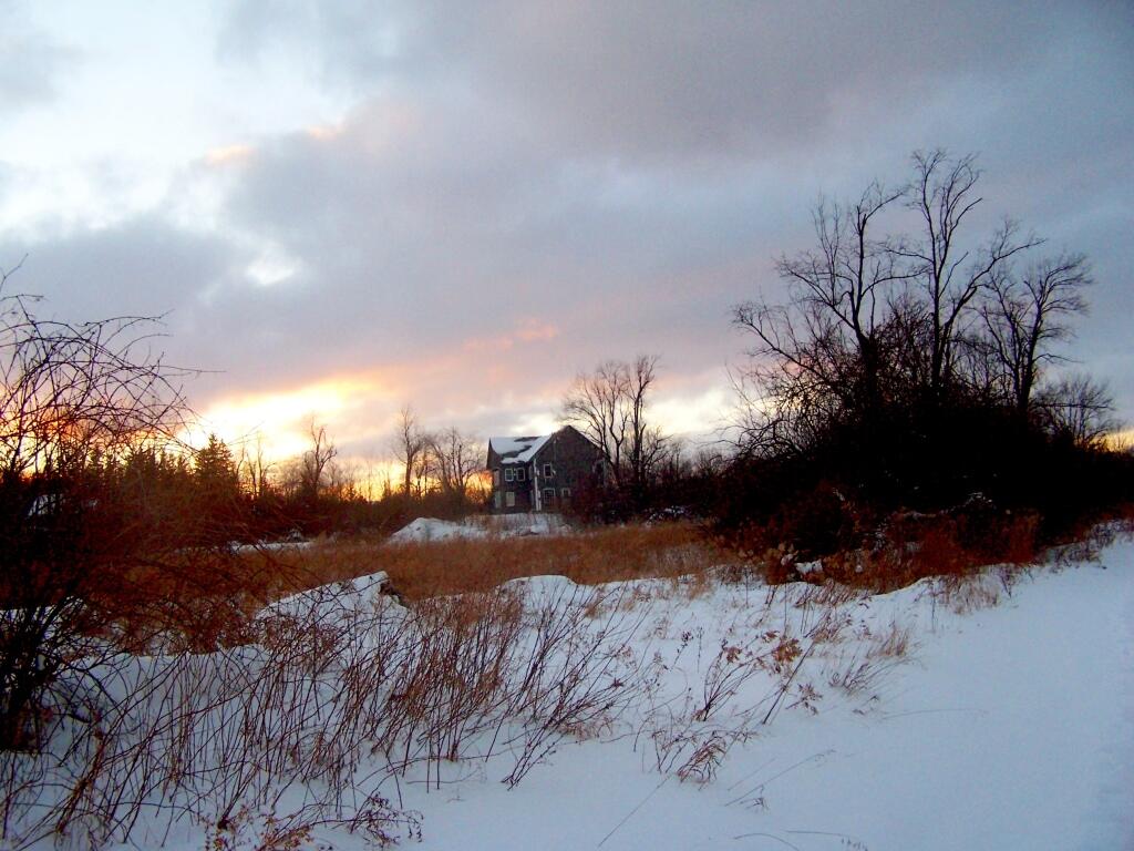
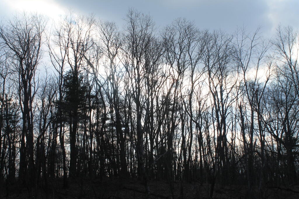
Good morning! Happy Sunday. Mostly sunny and 22 degrees at the Rensselaerville State Forest. ๐ŸŒž Deep blue skies with glittering trees with the sunshine. There is a north breeze at 7 mph. ๐Ÿƒ. Things will start to thaw out at Wednesday around 11 am. ๐ŸŒก๏ธ

Today will be sunny ๐ŸŒž, with a high of 32 degrees at 3pm. Two degrees below normal, which is similar to a typical day around January 25th. North wind 7 to 9 mph. A year ago, we had mostly sunny skies. The high last year was 18 degrees. The record high of 61 was set in 1991. 15.5 inches of snow fell back in 1926.โ„

Solar noon ๐ŸŒž is at 12:11 pm with sun having an altitude of 31.1ยฐ from the due south horizon (-39.8ยฐ vs. 6/21). Good for solar power. Except for the heavy frost we had last night kind of covering the panel on my truck. A six foot person will cast a 9.9 foot shadow today compared to 2.2 feet on the first day of summer. The golden hour ๐Ÿ… starts at 4:33 pm with the sun in the west-southwest (241ยฐ). ๐Ÿ“ธ The sunset is in the west-southwest (249ยฐ) with the sun dropping below the horizon at 5:14 pm after setting for 3 minutes and 7 seconds with dusk around 5:43 pm, which is one minute and 19 seconds later than yesterday. ๐ŸŒ‡ The best time to look at the stars is after 6:17 pm. At sunset, look for mostly clear skies ๐ŸŒ„ and temperatures around 28 degrees. There will be a north-northwest breeze at 9 mph. Today will have 10 hours and 9 minutes of daytime, an increase of 2 minutes and 25 seconds over yesterday.

Tonight will be partly cloudy ๐ŸŒƒ , with a low of 15 degrees at 6am. One degree below normal, which is similar to a typical night around February 3rd. Maximum wind chill around 9 at 5am; North wind around 9 mph. In 2023, we had cloudy skies in the evening, which became mostly clear by the early hours of the morning. It got down to 18 degrees. The record low of -15 occurred back in 1918.

Looking ahead, next Sunday is Don’t Cry over Spilled Milk Day ๐Ÿฅ› when the sun will be setting at 5:24 pm with dusk at 5:51 pm. On that day in 2023, we had mostly sunny, snow showers and temperatures between 38 and 23 degrees. Typically, the high temperature is 35 degrees. Definitely past the coldest time of the year by then. Heck it might be in the fifties by Friday. We hit a record high of 59 back in 1981.

Looking through the woods

Decided to head out for a night of winter camping ๐Ÿ•

It’s such a glistening and beautiful winter day here at the State Forest. I wish I had cross country skis after mine got worn out, snapped, then chopped up burnt last winter. So much fiberglass in those skis, and they held up for 20 years, but like all things, they don’t last forever.

Good afternoon! Partly cloudy and 26 degrees at the Rensselaerville State Forest. โ›… There is a north breeze at 10 mph. ๐Ÿƒ. The trees are still covered with snow and there is something we haven’t seen in a long time — blue skies. There is a 6 inches of snow on the ground. โ˜ƒ ๏ธThings will start to thaw out at Wednesday around 1 pm. ๐ŸŒก๏ธ

It is remarkably beautiful out today. ๐Ÿ˜€ Cold but beautiful. Yet that’s to be expected camping in the winter up in the mountains. The good news is the road is nice and solid this time for camping, so not playing in the mud or getting wet. The snow is frozen fairly solid, but also is light in fluffy. If I had skis, this would be almost ideal weather for skiing. ๐Ÿšฒ After lunch and finishing setting up camp ๐Ÿ• and gathering firewood ๐Ÿชต I plan to ride some of CCC Road and maybe go down to the OSI Parcel ๐Ÿ“ธ to look at the snow covered mountains. Then come back to camp and have a good fire. ๐Ÿ”ฅ

This afternoon will be mostly sunny ๐ŸŒž, with a high of 29 degrees at 2pm. Four degrees below normal. North wind around 11 mph. A year ago, we had mostly sunny skies. The high last year was 33 degrees. The record high of 57 was set in 2016. 6.1 inches of snow fell back in 2004.โ„

Solar noon ๐ŸŒž is at 12:11 pm with sun having an altitude of 30.8° from the due south horizon (-40.1° vs. 6/21). A six foot person will cast a 10 foot shadow today compared to 2.2 feet on the first day of summer. The golden hour ๐Ÿ… starts at 4:31 pm with the sun in the west-southwest (241°). ๐Ÿ“ธ The sunset is in the west-southwest (248°) with the sun dropping below the horizon at 5:13 pm after setting for 3 minutes and 8 seconds with dusk around 5:42 pm, which is one minute and 18 seconds later than yesterday. ๐ŸŒ‡ The best time to look at the stars is after 6:16 pm. At sunset, look for mostly clear skies ๐ŸŒ„ and temperatures around 27 degrees. There will be a north-northwest breeze at 11 mph. Today will have 10 hours and 6 minutes of daytime, an increase of 2 minutes and 23 seconds over yesterday.

One thing that’s nice about this time of year ๐ŸŒ† is we are definitely picking up more daylight in the evening, which makes it not as long at camp. That’s good as the nights can drag on. Going to be fairly cold but not super cold by the campfire for tonight, and I will have a nice fire.

Tonight will be mostly clear ๐ŸŒƒ, with a low of 18 degrees at 4am. Three degrees above normal, which is similar to a typical night around February 15th. Maximum wind chill around 9 at 1am; Northwest wind 8 to 13 mph. In 2023, we had cloudy skies in the evening, which became mostly clear by the early hours of the morning. It got down to 13 degrees. The record low of -13 occurred back in 1978.

Looking ahead to next weekend, the following Saturday is Clean Your Computer Day ๐Ÿงน when the sun will be setting at 5:23 pm with dusk at 5:50 pm. On that day in 2023, we had mostly cloudy, mild, rain showers and temperatures between 51 and 34 degrees. Typically, the high temperature is 35 degrees. We hit a record high of 53 back in 1955.

Gathering Clouds

My urge for camping ๐Ÿ• got the best of me โ˜ƒ

You know I’m happier in the woods than in any city, next to the fire burning things and having a good ol time. I knew last night was gonna be cold but it turned out not that bad though today will be cooler. Worked out good bar some issues with the camp stove last night and forgetting salt for the icy campsite and I’m glad to get away even if it’s just one night.

Good morning! Happy Sunday. Mostly cloudy with some snow flurries and 30 degrees at the Rensselaerville State Forest. โ˜ There is a south breeze at 9 mph. ๐Ÿƒ. The current wind chill is 22.

I decided to take option 3 and do a quick overnight trip to Rennselearville State Forest. โ›บ I think I’m going to take down camp soon and then head home before the front comes through and brings snow squals with strong winds and it’s cold enough the roads will ice up. I kind of wanted to do two โœŒ๏ธ nights but I decided it’s not that far if it ends up being one night. It is probably my best chance to get away a bit, next weekend I’m busy with the Reszin documentary and it looks even colder. โ„ Winter has arrived as we enter the coldest part of the year. Little worried too that I’m starting to get a bit of a chest cough, ๐Ÿ˜ท you know the one that’s been going around. I’m hoping it’s just a breathed in too much smoke last night.

But first a second pot of coffee โ˜•. Few snow ๐ŸŒจ flurries around and I shouldn’t procrastinate but the morning turned out nicer than I had expected with blue skies and a fairly slack wind. Enjoyed the last of the Mariaville Farm Bacon ๐Ÿฅ“ from local hogs on sale by Farmer Alice at For the Love of Bacon with the eggs ๐Ÿฅš and veggies this morning. ๐ŸŒ… It’s a treat with camping. Wasn’t sure if I was going to get the camp stove working, regulator is giving me trouble again. Wasn’t working at all last night. I slept with it to keep it warm last night and fiddled with the connection and dipped in rubbing alcohol and now it’s working again. Going to add a propane line filter and maybe pick up a second regulator to avoid problems in the future ๐Ÿ”ฎ.

Today will snow showers likely, mainly after noon. Partly sunny ๐ŸŒฆ, with a high of 35 degrees at 9am. Two degrees above normal, which is similar to a typical day around February 9th. Breezy, with a south wind 9 to 14 mph becoming southwest 17 to 22 mph in the afternoon. Winds could gust as high as 45 mph. Chance of precipitation is 70%. Total daytime snow accumulation of 1 to 2 inches possible. A year ago, we had light snow. The high last year was 30 degrees. The record high of 66 was set in 1932. 9.0 inches of snow fell back in 1999.โ„

The wind is what concerns me. ๐ŸŒฌ Some forecasts are talking about windchills especially tonight around 0 degrees. I am not sure I want to be camping out in, plus my camp stove has been acting up in the cold. I’m having issues again with the campstove regulator getting jelled up and plugged with dirt and condensate. I think when I can get home this week, I am going to order a second regulator for the campstove, plus another Big Buddy filter. โ™จ My other propane stove, whose burners ultimately burnt out a second time, had a few issues with this occassionally but this new stove I got last summer has constant issues now that it’s cold, though oddly not all on the Christmas trip to Madison County, though I stored it in the warmth of my truck. ๐Ÿšš Though if the Big Buddy filter works like it does with the Big Buddy Heater and the lantern, I expect smooth sailing going forward. ๐Ÿ˜ƒ It’s good to have back ups.

Solar noon ๐ŸŒž is at 12:06 pm with sun having an altitude of 26.1ยฐ from the due south horizon (-44.8ยฐ vs. 6/21). A six foot person will cast a 12.2 foot shadow today compared to 2.2 feet on the first day of summer. The golden hour ๐Ÿ… starts at 4:03 pm with the sun in the southwest (234ยฐ). ๐Ÿ“ธ The sunset is in the west-southwest (241ยฐ) with the sun dropping below the horizon at 4:47 pm after setting for 3 minutes and 18 seconds with dusk around 5:18 pm, which is one minute and 9 seconds later than yesterday. ๐ŸŒ‡ At dusk you’ll see the Waxing Crescent ๐ŸŒ’ Moon in the southwest (216ยฐ) at an altitude of 29ยฐ from the horizon, 226,294 miles away. ๐Ÿš€ The best time to look at the stars is after 5:53 pm. At sunset, look for snow ๐ŸŒจ and temperatures around 29 degrees. The wind chill around sunset will be 16. โ˜ƒ๏ธ Breezy, 22 mph breeze โ›… from the west with gusts up to 44mph. Today will have 9 hours and 26 minutes of daytime, an increase of one minute and 33 seconds over yesterday.

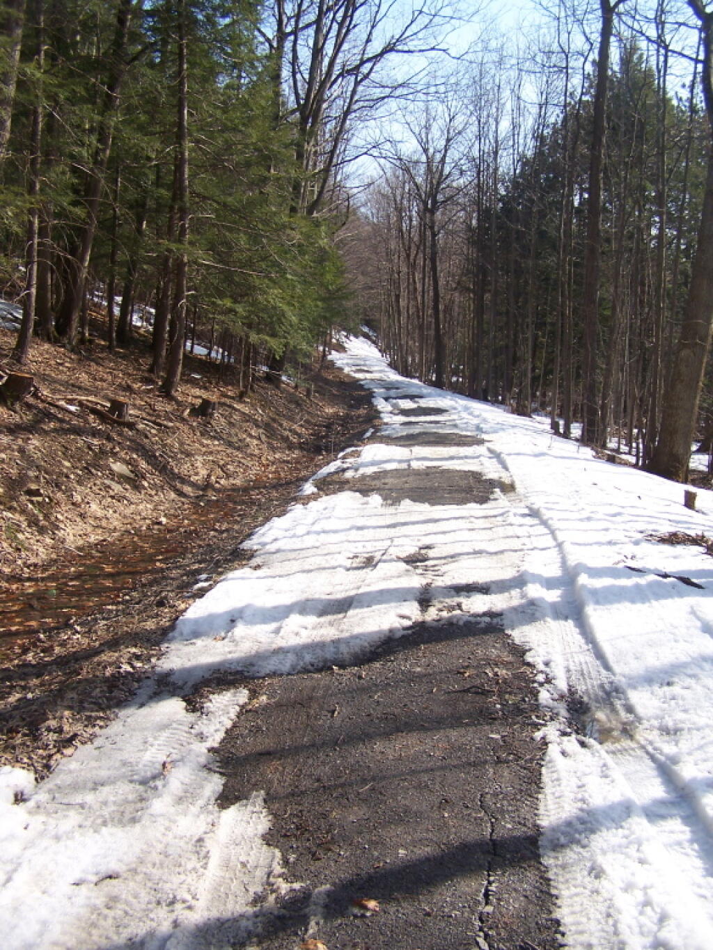
I am worried enough about the possibility of white out conditions driving home ๐ŸŒซ that I want to be on the road by 11 AM. I am going to sip my coffee, then take my campsite down before it gets too late. I could for a walk, and the road is hard enough for a bike ride now, but I think I’d rather just head home and avoid the risk of driving on snow-covered roads. Its not like I am on the other side of the earth — it’s a 21 mile drive that takes roughly a half hour, as most of the road is 55 MPH bar Clarksville and Rensselearville. I’m right on a plowed dirt road, and 1,000 feet from asphalt so I’m not worried about being snowed in, but driving home on those hills in snow and ice, could be kind of miserable.

Tonight will be partly cloudy ๐ŸŒค, with a low of 17 degrees at 4am. One degree above normal, which is similar to a typical night around February 11th. Maximum wind chill around 9 at 3am; Breezy, with a southwest wind 17 to 22 mph decreasing to 9 to 14 mph after midnight. Winds could gust as high as 33 mph. Other weather reports are calling for a wind chill closer to 0. I don’t mind such cold when I’m in the truck protected from the wind, but during the evening next to campfire ๐Ÿ”ฅ that would be downright cold, I’m afraid. Wind worries me more then cold, as it sucks the heat away from your body. That said, my gear is really good for camping down to about 10-15 degrees, much colder then that at night in my unhreated truck cap it gets cold. In 2023, we had light snow in the evening, which became cloudy by the early hours of the morning. It got down to 19 degrees. The record low of -20 occurred back in 1957.

Still I’m glad I got away for one day. ๐Ÿ˜€ Just a night in the woods puts a smile on my face. Despite the woods being wet from rain we’ve had, it was cold enough up here in the State Forest that ground was frozen solid and was able to have a good fire. I’ll head home, get unpacked — it’s not that much stuff for one night ๐Ÿ’ผ — and shower. ๐Ÿšฟ Maybe go for a bike ride this afternoon ๐Ÿšด or down to the library ๐Ÿ“š if conditions aren’t too harsh. Or maybe cook up a big pot of chicken soup, ๐Ÿฒ especially if I’m not feeling good. I am thinking my next trip will be Presidents Day to Moscow Hill Horse Camp ๐Ÿ‡ in Madison County, but we’ll see. Get some nice weather, and maybe I’ll head back to the wilderness sooner for a weekend trip, like during my 41st birthday weekend, though winter is tough. Next weekend will be too cold it appears, plus the Reszin documentary.

Looking ahead, next Sunday starts the Coldest Week of the Year ๐ŸŒฌ when the sun will be setting at 4:57 pm with dusk at 5:26 pm. Martin Luther King ๐Ÿ‘‘ weekend is early this year. On that day in 2023, we had snow showers, cloudy and temperatures between 33 and 30 degrees. Typically, the high temperature is 32 degrees. We hit a record high of 61 back in 2006.

Abandoned Farm House